Highway 101: The Ultimate West Coast Drive
It doesn't get much more iconic than this 1,540-mile stretch.

Imagine you've been asked to design a college course that explores the West's principal automotive routes, the arteries that move the region's commercial, social, and cultural lifeblood. What would you call it?
How about "Highway 101"?
Because no matter what you call the road that was originally El Camino Real—whether you know it as the Central Freeway, Oregon Coast Highway, Hollywood Freeway, Redwood Highway, or Olympic Highway—you could do a lot worse than make U.S. Route 101 the focus of your class. The 1,540-mile stretch of roadway races along the continent's western edge, tying together Los Angeles and the Strait of Juan de Fuca in a trajectory vibrant with romantic history, commercial vitality, scenic dazzle, and urban energy—a truly omnibus road. (In fact, in the San Francisco Bay Area, you can see omnibuses full of tech workers cruising up and down 101 every day.)
Sure, the big interstates—like I-5 or I-80—might carry more vehicles. They offer a certain numbing efficiency; a trip on any of them is better captured with a stopwatch than a camera. Highway 101, on the other hand, varies from eight-lane freeway to two-lane highway, from city street to country road. It has tunnels, grades, and bridges both beautiful and useful. (The latter include the four-mile Astoria-Megler Bridge built in 1966 across the Columbia River, the final segment of 101 to be completed.) It passes by the site of the world's first motel—the Milestone Mo-Tel, opened just off 101 in San Luis Obispo in 1925. It runs past Los Angeles City Hall at its southern terminus, the Washington State Capitol in Olympia at its northern end, and in between, San Francisco City Hall with its magnificent dome and the Frank Lloyd Wright–designed Marin County Civic Center.
My enthusiasm for Highway 101 is not merely academic. When I was growing up in Hollister, California, 101 was 11 miles away, the on-ramp to Santa Cruz, Monterey, San Jose, and San Francisco. Today I live in San Francisco, about a six-minute drive from 101. My daughter Claire just started college 330 miles away in Santa Barbara; she can travel all but three miles of that distance on 101. Yes, it's the King's Highway, but it's also the Andersons'.
Some might object to calling 101 the West's most iconic highway. "What about Route 66?" they might ask (with an echo of Nat King Cole's croon). I'd say the song itself answers that question. Route 66 (which the U.S. Highway System officially decertified in 1985) was always more about the destination than the journey, a means to get somewhere else: "It winds from Chicago to L.A. / More than two thousand miles all the way."

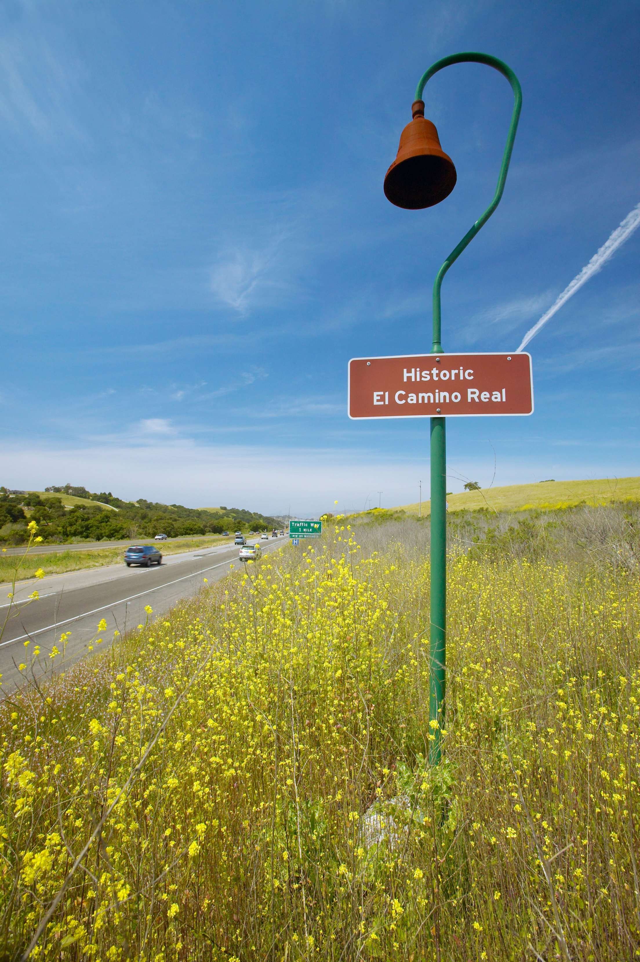
Mission bells line Highway 101 from Los Angeles to Sonoma, California.
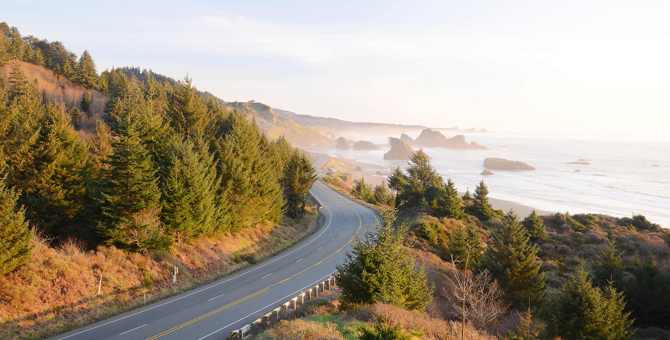
When you drove on Route 66, you were passing through a desert, literally and metaphorically. When you drive Highway 101, you pass through valleys—the San Fernando, Santa Ynez, Salinas, Santa Clara, and Silicon, among others, each fecund in its own way. The road is never far from epic water, hugging the Pacific Coast for hundreds of miles and crossing the mouths of the San Francisco Bay and the Columbia River. At its far northern reach, it wraps through and around Olympic National Park, along the park's 73 miles of rugged coastal wilderness and through its emerald rain forests. In Oregon, the highway touches an astounding 77 state parks and the spectacular Oregon Dunes National Recreation Area. In Northern California, it leads to the Avenue of the Giants—a portion of the old Highway 101 in what is now Humboldt Redwoods State Park—giving travelers a chance to crane their necks ogling some of the tallest trees on the planet.
Which is exactly what I did on my first long road trip when I was a kid, a two-week sprint up and down the West Coast with my parents and three siblings. We stopped in Scotia, California, to see how a sawmill reduces big trees to board feet. We lumbered farther up 101 to Oregon to comb the beaches in Newport and Lincoln City, savor ice cream at the Tillamook Creamery, and pose for snapshots before the winter quarters of Lewis and Clark outside Astoria. We crossed into Washington, where we explored Olympic National Park before touring both the state capitol and the now-gone Olympia Brewery (once again, epic water).
Highway 101 is also a survey course in Western history—or mythmaking. It's commonly believed the highway got its start nearly 250 years ago as El Camino Real, a horse path linking 21 Franciscan missions in Alta California. Today, a series of instantly recognizable roadside bells mark that route. But that story may owe more to the romantic notions of regional boosters than to the conclusions of rigorous historians. And while mission founder Junípero Serra remains controversial (because of the impact those missions had on American Indians), there's no question that he was an urban visionary. He built missions in or near what would become the four largest cities on the West Coast: San Diego, Los Angeles, San Jose, and San Francisco.
The final exam for Highway 101? Essay question: Tell us about your favorite stretch of the road.
For me, the answer would be the Golden Gate Bridge. The 1.7-mile-long span—with the Pacific and the Farallon Islands to the west; the bay, Alcatraz, and the San Francisco skyline to the east; and art deco towers soaring 500 feet overhead—still raises goose bumps every time I cross it.
The bridge in many ways is a microcosm of Highway 101 itself: an engineering marvel that required extraordinary innovation, collaboration, and foresight to complete, and an indispensable link between north and south, connecting urban dynamism with untrammeled nature and untapped opportunity.
Let the AAA Complimentary Travel Agents help plan your next road trip. Discover Members-only discounts on car rentals, hotels, and more.