
Welcome to Beautiful Cascadia
The beautiful bioregion woos nature lovers with redwoods, rushing rivers, and awe-inspiring animals.
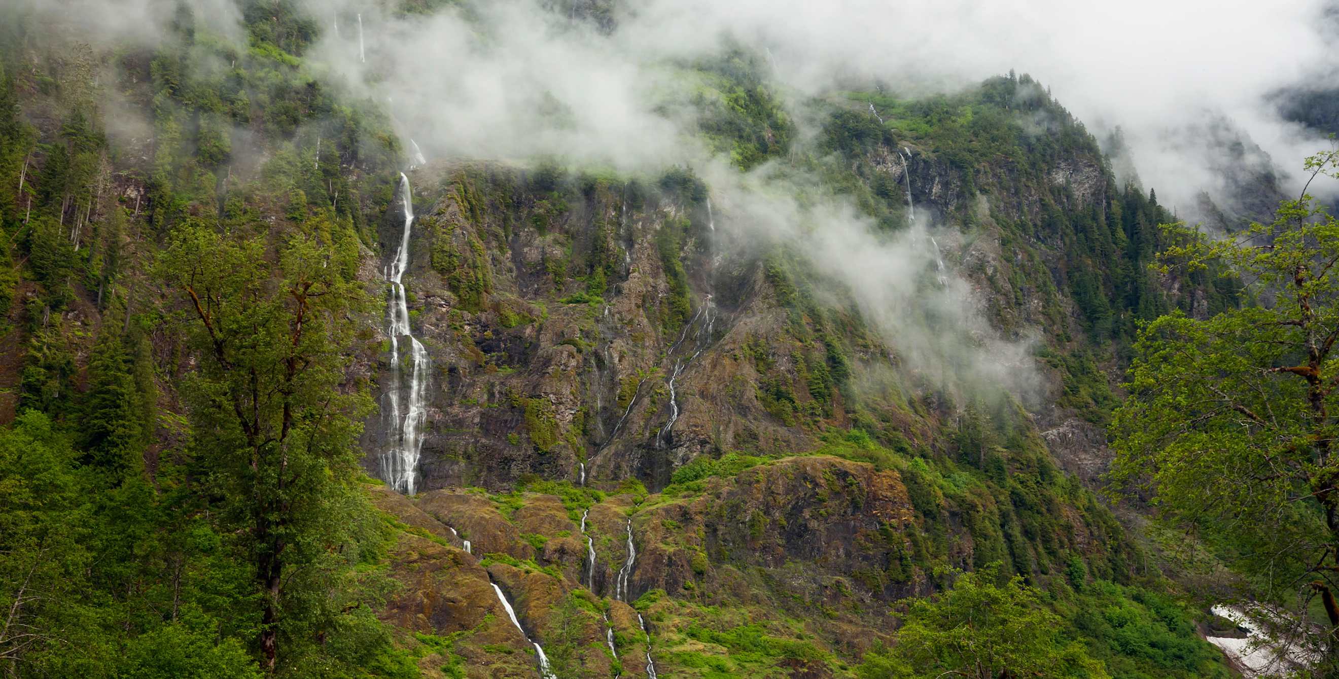
Fog shrouds towering evergreens, clouds catch on snowcapped volcanic peaks, and fish-filled rivers roll toward the Pacific. Is this California? Alaska? Somewhere in between? It could be any of those places or all of them, because scenes like this repeat up and down the western edge of North America. They’re the emblems of a bioregion—defined by natural characteristics such as topography and climate, not by borders people draw on maps—that encompasses the West’s coastal ranges as well as the Columbia River’s vast watershed. It even has a name: Cascadia.
Embracing 600,000 square miles of some of the wildest beauty on the continent, Cascadia is united by its rivers and waterfalls, its volcanoes and vast mountain ranges, its wildlife (including bears, orcas, and elk) and its indigenous human cultures. Visiting any one part of it will give you a feel for the entire region. But the more you explore, the more you’ll understand how each spot fits into the greater bioregional whole. The effort will also lead you to see familiar terrain in a new way.
Olympic National Park, Washington
Just a couple of hours from Seattle, you can walk among spruces, firs, and hemlocks in the rain forest of Olympic National Park. “It’s the way things used to look before humans,” says David Banis, a geographer at Portland State University. The loudest sounds come from rushing creeks, crashing waterfalls, and booming grouse.
Some of the best and most popular views pop up along the steep, winding 19-mile drive from the rocky coast at Port Angeles to Hurricane Ridge in the Olympic Mountains; it’s a greatest-hits package of the landscapes that define Cascadia. But the roads here barely penetrate the rain forest, and drivers enjoy only a small taste of the real park. “To really get into the wilderness, you have to power yourself,” Banis says.
The Boulder Creek Trail, in the Elwha Valley near the park’s northern border, leads to natural hot springs*. Hikers in the glacier-carved Enchanted Valley, along the Quinault River in the park’s southwestern corner, lose count of the rain-fed waterfalls plunging down rocky cliffs. Colossal forces of nature might have created the park and Cascadia, but along these and Olympic’s other rain forest trails, it’s the stillness that you notice. *Editor's note: The Elwha area is still closed to vehicles beyond the Madison Falls parking area due to flood and road damage as of November 2022.
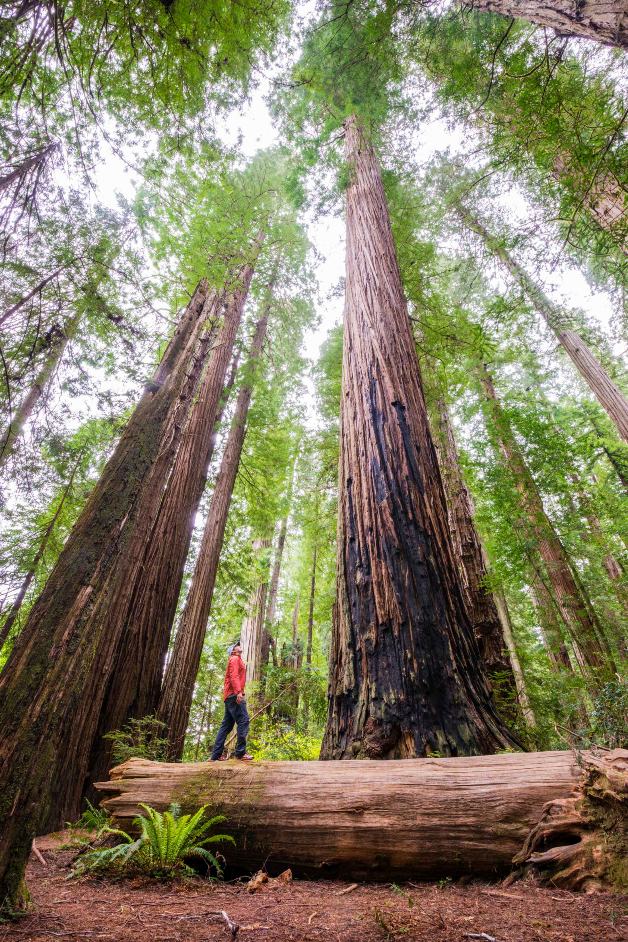
Stout Grove's trees tower hundreds of feet.
Redwood National Park, California
Everything about Cascadia—the climate, the soil, the water—inspires big trees. Redwood National Park and the California state parks nearby are home to the world’s tallest redwoods, which are the tallest trees of any kind anywhere. As you strain your neck to take in the giants soaring 300 feet above Stout Grove at Jedediah Smith Redwoods State Park, you’re reminded of your size in the universe. “Stepping into a grove of redwoods is like walking into a cathedral,” says Sungnome Madrone, an ecologist at Humboldt State University.
While redwoods once covered much of the planet, California—particularly the Cascadian part of it—is the only place they survive, outside of an odd variety in China. Why here? It’s the fog. Too tall to pump water from roots to crown, redwoods rely on wet banks of moisture rolling in from the coast, which Cascadia supplies in abundance.
The trees aren’t the only wilderness life to behold. Roosevelt elk graze meadows around Prairie Creek Redwoods State Park, and coho and chinook salmon return each fall and spring to the Klamath, Eel, and other area rivers. Madrone calls the salmon the totem animal of the region. The totem tree? No question: It’s tall, red, and completely Cascadian.
Teton Valley, Idaho
The western foothills of the Tetons—perhaps the most iconic mountains of the West—are far from the coast. But streams flow from those hills down through Teton Valley to part of the Snake River, which is in turn a major tributary of the Columbia, the centerpiece river of Cascadia that flows to the sea. This continuity makes Teton Valley, on the Idaho-Wyoming border, the best place to explore the region’s southeastern apex.
The forests covering the valley’s slopes are more open than those in coastal Cascadia, which makes for wider vistas. “We get outstanding views of the Tetons,” says Beverly Charette, a local naturalist and guide. The Teton Canyon Trail, which leads into the Jedediah Smith Wilderness, stays relatively flat and wide for many miles before climbing (as all trails around here eventually do). Heartier walkers can take on Table Mountain; from its top, the peaks of the Tetons look close enough to touch.
The water that drains from these mountains is a lifeline for native cutthroat trout and the anglers who fish them, wading moose, and the occasional grizzly bear browsing huckleberries. Wherever she takes hikers, Charette talks about connections. “The whole environment works together—the soil, the plants, the rodents, the larger animals, the predators,” she says. It’s as true for Teton Valley as it is for Cascadia in its entirety: Small things link to big, every part knitted into the whole.
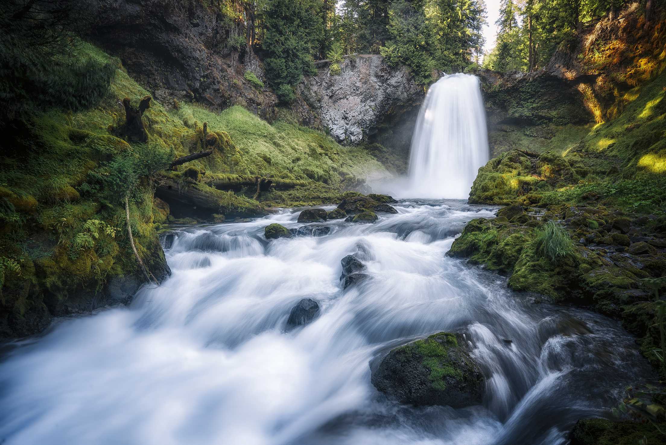
McKenzie's Koosah Falls spans 70 feet when full.
Mckenzie River, Oregon
Cold, clean, crystalline water is a Cascadian specialty. One shining example: the McKenzie River of central Oregon. Fed by springs high in the Cascade Range, the McKenzie runs clear and strong all year to its confluence with the Willamette River, north of Eugene.
Local author Dan Gleason likes to start his McKenzie adventures at the river’s beginning: Clear Lake. Formed 3,000 years ago when a lava flow blocked the river, Clear Lake profoundly lives up to its name. Trees submerged for millennia are still visible under 120 feet of water. It’s a classic mountain lake, ringed with campsites, rustic cabins, and docks with rowboats and kayaks for rent.
From Clear Lake, the McKenzie plunges and tumbles through narrow gorges carved out of lava rock, creating a pair of powerful waterfalls. “It’s some of the most spectacular white water you’ll ever see,” Gleason says, but it’s too wild for any vessel. Eventually, though, the river mellows out, opening up new possibilities.
Anglers seek out the chinook salmon and rainbow trout that crowd the pools and riffles. A bird guy, Gleason likes to watch ospreys and American dippers do their own hunting on the water. The quintessential McKenzie experience takes place in a boat. Plenty of rafting companies will bring you down the river from Belknap Springs or McKenzie Bridge. Peer over the edge of your drift boat in one of these quieter stretches, and you can see sunlight rippling on the rocky bottom.
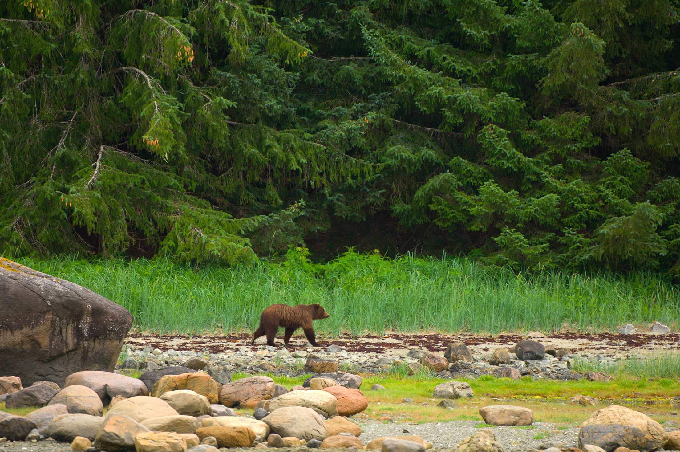
A brown bear roams a beach near Sitka.
Sitka, Alaska
While some consider the salmon to be Cascadia’s emblematic animal, others would say it’s the bear. One of the most promising places to see the shaggy giants is near Sitka, Alaska. This onetime Russian outpost turned city of 9,000 people shares Baranof Island, in the state’s southeastern Panhandle, with 1,000 brown bears, one of the densest bear populations in the world.
Which is not to say they’re easy to see. “They stay well out of town,” says Claire Turner, a volunteer for Sitka’s Fortress of the Bear. At this enclosed refuge for orphaned animals, you can count on a safe up-close bear encounter. Turner helps feed and care for three black bears and five coastal brown bears, making sure their diet follows natural Sitka rhythms. When salmon are running, her bears catch live fish from pools. If you want to see bears fishing in the wild, a trip by boat or floatplane from Sitka to Redoubt Bay will get you close to some of their favorite spots.
Sitka is also a great place to learn about Cascadia’s human history. Totem poles of the Tlingit tribe stand not far from Russian buildings more than 150 years old; fishing boats dock next to yachts from around the world. But reminders of the area’s essential wildness are everywhere. On her drive to work, Turner sees humpback whales making their own commute in the bay.
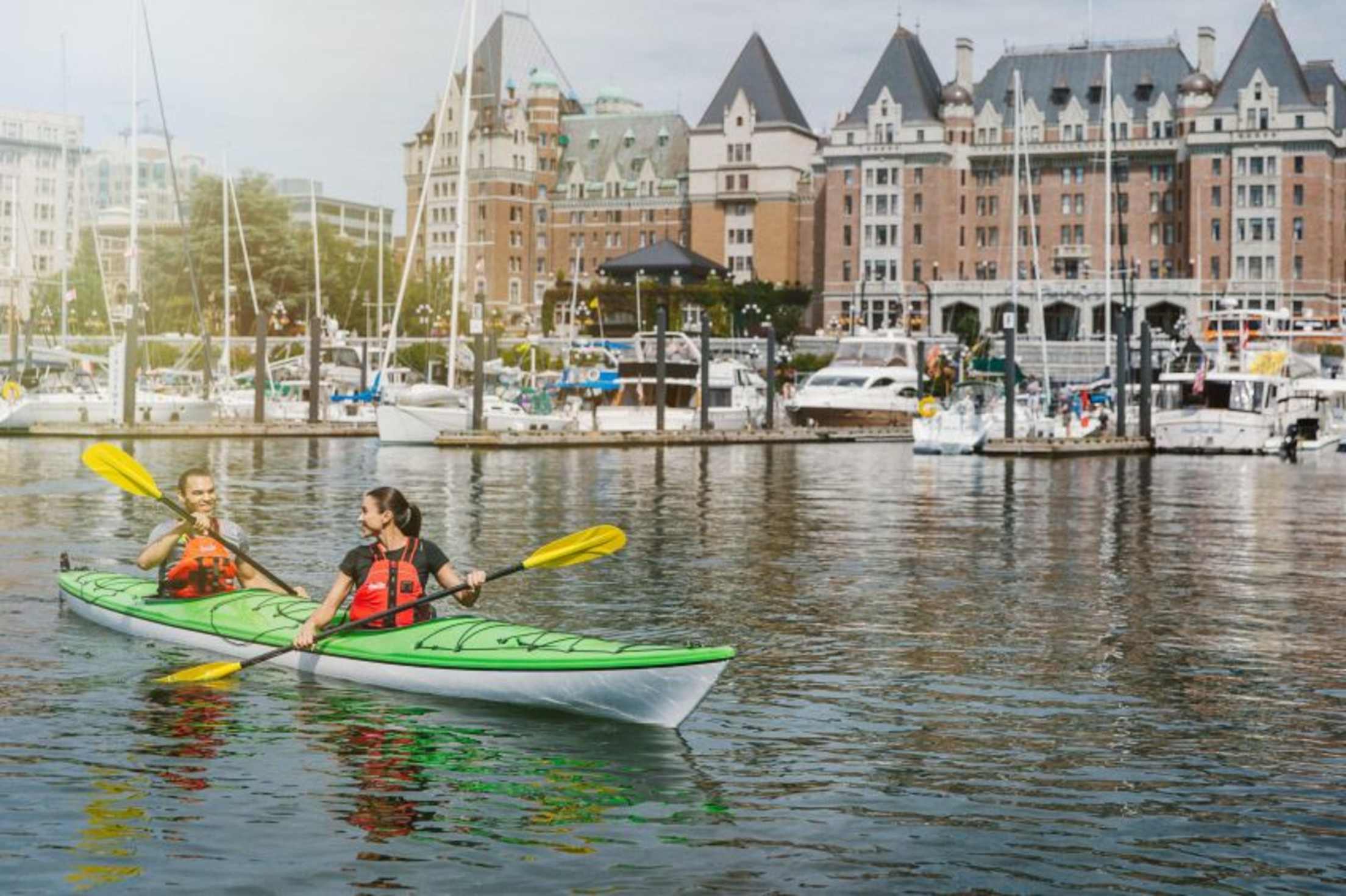
Kayakers tour Victoria's historic Inner Harbour.
Victoria, British Columbia
Vancouver Island, off the British Columbia coast, is home to almost everything that makes Cascadia special. In Strathcona Provincial Park, the braided strands of Della Falls plunge more than 1,400 feet, making it one of the tallest falls in Canada. Orcas frolic just offshore, bears prowl the beaches, and Douglas firs—including a 242-foot giant near Port Renfrew—stand tall on the island’s verdant southwest coast.
But Vancouver Island is also home to one of Cascadia’s most civilized cities, Victoria, an excellent base of operations for exploring all that wildness. It’s a bastion of urban comforts where you can enjoy tea, scones, and manicured gardens without losing sight of the region’s natural appeal.
That combination has inspired a thriving community of artists, including Lisa Riehl, a painter and surfer. Riehl takes her board up the island’s west coast to Jordan River, a logging town where seals and wet-suited surfers brave the chilly currents. Closer to the city, she hikes through the red cedars clinging to coastal cliffs at East Sooke Regional Park. She takes her camera wherever she goes, looking for scenes to recreate on canvas. “This is hands down the most beautiful place I’ve ever seen,” she says.
Get more out of your vacation: Book through AAA Travel for exclusive Member benefits.