New Hiking and Biking Trails in the West
Here are eight new trails, from cross-state bike routes to family-friendly hikes.

One of the most enjoyable ways to experience the West is by trail, where you’re immersed in the sounds, scents, and scenes of the region’s diverse landscape. Every year, trail-building organizations create more opportunities for travelers by restoring existing trails and creating miles and miles of new ones. Out of the thousands of trails to choose from, here are seven new and noteworthy trails that have recently opened or been improved for hiking and biking in Arizona, California, Nevada, and Utah.
California
Last summer, the Adventure Cycling Association helped coordinate the development of a handful of new routes, including two in California, to add to the U.S. Bicycle Route System, a growing national network of bike routes. Explore U.S. Route 66 on two wheels with USBR 66, which shadows the historic highway for nearly 330 miles. The full route begins at the Arizona border near Needles, crosses the Colorado River and high-desert National Trails Highway, and ends at the Santa Monica Pier. Other highlights include following the nearly 20 miles of the Pacific Electric Bikeway in the San Gabriel Valley and riding through Chinatown and Hollywood in Los Angeles.
The other new California route is USBR 95, which follows scenic U.S. Highway 101 and the Pacific Coast for 440 miles from the Oregon border to San Francisco. After entering Crescent City, California, the route travels through redwoods in Eureka, climbs and descends coastal headlands, passes over the Russian River, continues on to Sausalito, crosses the Golden Gate Bridge, and finishes on the southern edge of San Francisco.
Both cross-state routes are a mix of backroads, some highways with good shoulders, bike lanes, and paths that are separated from the road when available. You can easily break these routes up into sections for day rides, including shorter stretches along the coast in Eureka, Mendocino, Bodega Bay, or Point Reyes.
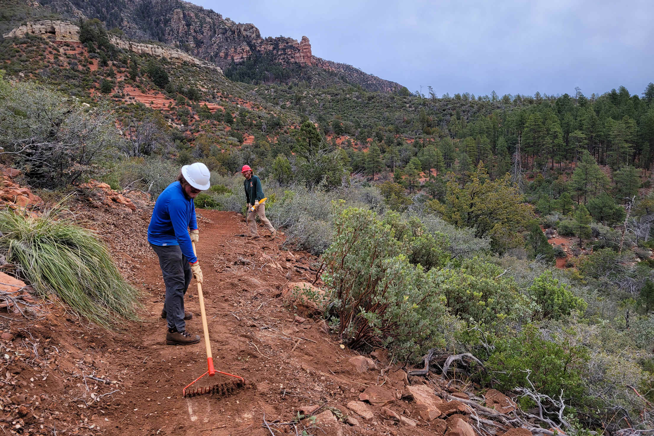
Highline National Recreation Trail.
Arizona
First used as a travel corridor for homesteaders around the towns of Payson and Pine in the late 1800s, the Highline National Recreation Trail was officially designated in 1978. But over the last several decades, the 51-mile trail has fallen into disrepair with sections significantly eroded. The National Forest Foundation and Forest Service have initiated a restoration project to upgrade and improve the trail for hikers, bikers, and equestrian riders. Trail builders are improving the path’s grade, removing obstacles, and adding signage for hikers, bikers, and equestrian riders. The trail restoration is being completed in phases, with the first scheduled to be finished by the end of 2022.
Nevada
Until the first part of the 600-mile Lost Sierra Route opens in the Sierra Nevadas (expected in 2023), there are shorter trails to explore. In Ely, the 3-mile non-motorized Total BS Trail (named after the builders Bryane and Suzie) connects Ward Mountain with Iceplant Canyon. This stretch is the most beginner-friendly trail climbing up from downtown Ely, with Tokie Dokie and Powderberry Divide as the advanced options. The trails have views of the 11,000-feet Ward North and South Peaks and the 13,000-foot Wheeler Peak in Great Basin National Park.
The small eastern Nevada town has expanded its system of trails by about six miles in the last three years. This summer, the Bureau of Land Management received a grant to build 20 more miles as part of a bigger project to expand the area’s Garnet Hill Recreation Area, a garnet rock collecting site. Also, with the Ward Mountain Trail Expansion Plan, 30 miles of non-motorized singletrack will be added along with trailhead improvements, building on Ely’s already impressive mountain bike trail system.
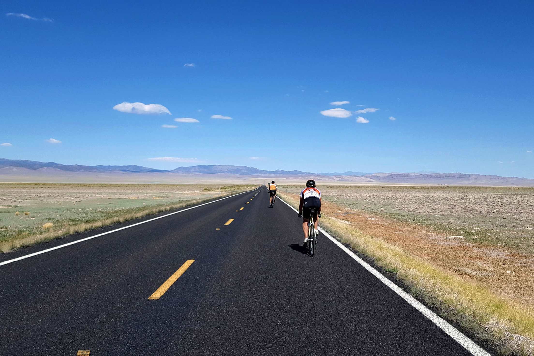
Cyclists ride on the USBR 79 route near the Utah-Nevada border.
Utah
Near Zion National Park, officials opened the first 10 miles of a mountain bike trail system that loops just outside the park’s eastern edge. A new visitor center, the park’s third, is just down the road. Currently in the fundraising stage, future phases of the East Zion Initiative will create more trails for mountain bikers and hikers.
For cyclists, the Adventure Cycling Association supported the establishment of two new cross-state biking routes that link backroads, bike lanes, highway shoulders, and paths. The 350-mile USBR 77 begins at the Idaho border and travels along the Wasatch Front from Ogden to Salt Lake City to Provo, then climbs between the mountains of Fishlake National Forest, and ends in Torrey near Capitol Reef National Park.
USBR 79 is a 269-mile route that begins at the Nevada border and ends at the Arizona border, crossing high desert, climbing toward painted cliffs and pinnacles of Cedar Breaks National Monument, and flattening out in the Navajo sandstone.
For a shorter ride, it’s possible to enter and end each of these routes from points along the way.