
Wild West Road Trip Through Southeast Arizona
Road-trip through southeast Arizona and find history in the ranches, mines, and ghost towns.
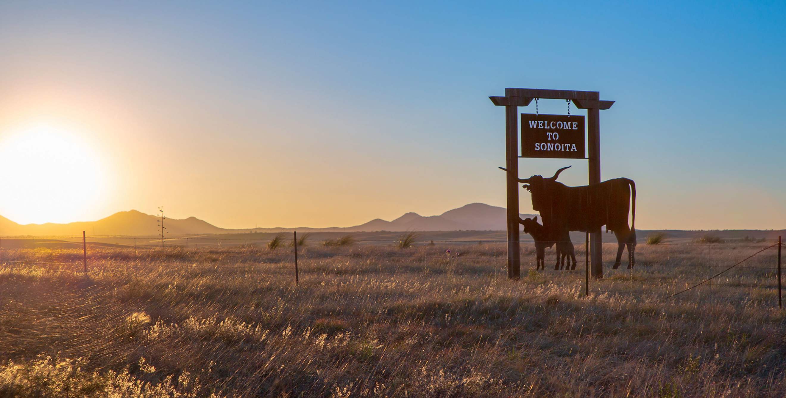
It's some 80 miles from Tucson to Tombstone, the storied "town too tough to die." But it's not a journey that can be fully measured in distance. As you depart the bustling city of Tucson and head into Arizona's southeast corner, the urban landscape melts away and the scenery changes entirely. Towering peaks rise from the desert, broad valleys open up before you, and you enter a land of legends.
This wild countryside is where Geronimo led his band of Chiricahua Apache, and Wyatt Earp shot his way into Western lore. Pancho Villa launched cross-border raids here, and miners hacked and blasted billions of dollars' worth of copper, gold, and silver out of the rich hillsides. In this stretch of rangeland, the spirit of the Old West lives on at such sites as the Gadsden Hotel in Douglas, a grande dame built on copper wealth, and Slaughter Ranch, the remnant of a massive cattle empire.
As dedicated history buffs, my wife Becky and I have always wanted to explore this area. Now we're driving a meandering 400-mile loop from Tucson through a string of small towns and national monuments. The route traverses countryside where windmills whirl in the breeze and pronghorn still bound across sagebrush flats little changed over the centuries.
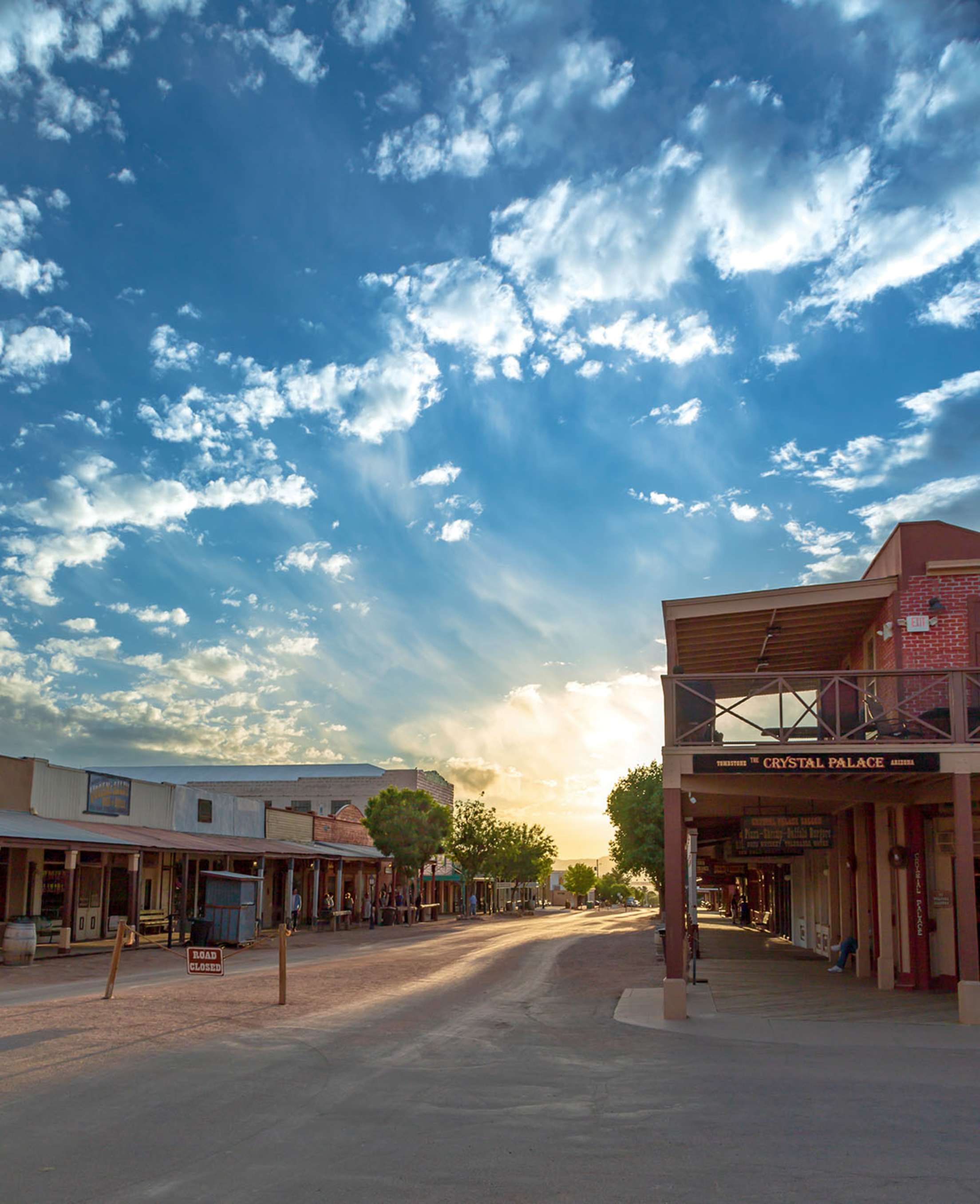
The sun sets over Allen Street, Tombstone's main drag.
Big Views, Tall Tales: Sonoita to Tombstone
Outside Tucson, we leave the traffic on I-10 behind and follow southbound Highway 83. The road winds through Davidson Canyon, where gray and rust-colored slopes are sprinkled with spindly ocotillo and thickets of prickly pear. Before long, we emerge into the high-desert grasslands of Sonoita.
"Driving in from the foothills, especially near sunset or early morning, when you see the sun on the rolling hills, the beauty is just overwhelming," says Gail Getzwiller, a transplant from Illinois. "I know I had an emotional reaction. When I first saw it, I immediately wanted to live here."
Getzwiller's husband Steve is a renowned collector of Navajo weaving, Zia Pueblo pottery, and Zuni jewelry. The couple run the Nizhoni Ranch Gallery out of their hacienda-style house high atop a hill overlooking the Babacomari Valley. Steve grew up nearby, on a ranch outside Benson, and, when he was 18, he traded his collection of Winchester .22 rifles for his first Navajo weavings.
In the five decades since, Steve has worked closely with Native craftspeople in northeast Arizona, providing them with hand-dyed Churro wool so that even contemporary works retain the look and feel of traditional textiles. The fruit of that collaboration is on display around the gallery, where elaborately geometric, museum-quality Navajo blankets hang on the walls, and subtly patterned Hopi baskets sit atop antique side tables.
As spectacular as the collection may be, we keep stealing glances at the view. Noting our gazes, Steve looks out the window.
"You can see 14 mountain ranges from here," he says, gesturing to a panorama that extends eastward past the rugged silhouette of the Huachuca Mountains all the way to snowcapped Mount Graham, over 100 miles away. Ever the rancher, he adds, "And this is some of the finest Angus grazing land you'll find anywhere."
From Sonoita we continue east on Highway 82 through the rangelands of the Rain Valley, with a gray, dome-shaped volcanic knob fondly known as the Biscuit rising to the south. The highway then drops from the range into the lush San Pedro Valley, where the cottonwood forest along the San Pedro River traces a green line across the tawny expanse. We pull into the ghost town of Fairbank, once home to Tombstone's railroad stop. Though it's empty today, the place still has an orderly feel, with mesquite-shaded buildings laid out in rows around a dirt plaza. The restored schoolhouse now serves as a museum.
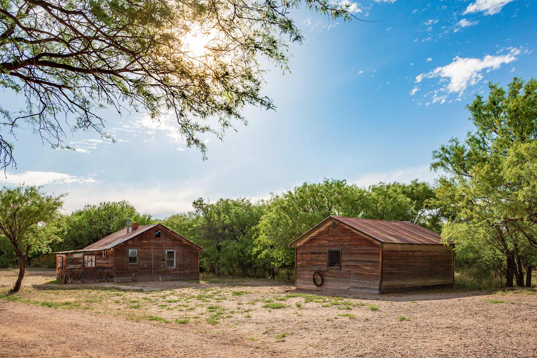
History lives in the ghost town of Fairbank.
From the stillness of Fairbank, it's barely nine miles to touristy Tombstone. Once a thriving mining town with 10,000 residents (and more than 100 saloons), Tombstone is now infamous; its name has become shorthand for the Wild West's dark heart. Our first stop is Boothill Graveyard, so named because, according to legend, many of the people buried here died with their boots still on. The wind blows hard as we pick our way through rocks and brambles to read the names on the crosses and headstones. The brochure that comes with the $3 admission lists the many and sundry ways people perished here: gunfights, stampedes, mining accidents. The leading cause of death in Tombstone appeared to be living in Tombstone.
With flags flying on the false-front buildings and a cherry-red stagecoach rolling up and down its dusty main drag, Tombstone certainly looks like the quintessential Old West town, albeit with infinite ways for modern visitors to drop a few bucks while they're here. But really, the stagecoach rides, souvenir shops, and greasy spoons all owe their existence to a significant 30 seconds or so back in 1881, when the Earp brothers, along with the dentist and gambler Doc Holliday, engaged in a shoot-out with the cattle-rustling McLaury and Clanton brothers and their outlaw pal Billy Claiborne.
The gunfight first inspired dime novels, then a biography of Wyatt Earp, and finally a slew of westerns, from the John Ford classic My Darling Clementine to a pair of films released within six months of each other in the 1990s. Pick your favorite Earp: Kurt Russell or Kevin Costner?
These days, the combatants, clad in black dusters, meet downtown to reenact the shoot-out four times daily (except for Thanksgiving and Christmas). Spoiler alert: The Earps win.
Copper Country: Bisbee to Douglas
A short drive on Highway 80 delivers us to Bisbee. In the past, we've seen Bisbee in the same ways that most visitors do. We've climbed the network of staircases that lace the rust-red canyon walls around town.
We've walked the city streets, admiring the historic stone and brick structures built in Gothic, Italianate, and Romanesque styles. These ornate edifices seem to belong in a big city on the East Coast, not a town of 5,200 in southern Arizona.
But today, we're going to see the source of Bisbee's wealth and fame: We're visiting the old copper mine. Outfitted in hard hats and safety vests for the Queen Mine Tour, we climb aboard the "man cars" that workers once rode underground at the start of their shifts.
With a lurch, the train rolls forward and enters the side of the mountain. It feels as though we're on the world's slowest roller coaster. The train clatters and screeches within the narrow confines of ruddy, rough stone walls as it creeps 1,500 feet through the cavelike tunnel—one tiny branch of the complex web that runs beneath Bisbee, burrowing a total of 2,500 miles. Like many of his family members, our guide, Don Carbajal, worked in a local mine himself. He kept at it until Bisbee's mines closed in 1975, after nearly a century of operation.
On the way out of Bisbee, bound for Douglas, we pass the massive, terraced crater of the Lavender Open Pit Mine before Highway 80 leaves the Mule Mountains to cross the flats of the Sulphur Springs Valley. Douglas prospered after Bisbee's processing facilities moved there in the early 1900s, earning the town the title "Smelter City of the Southwest."
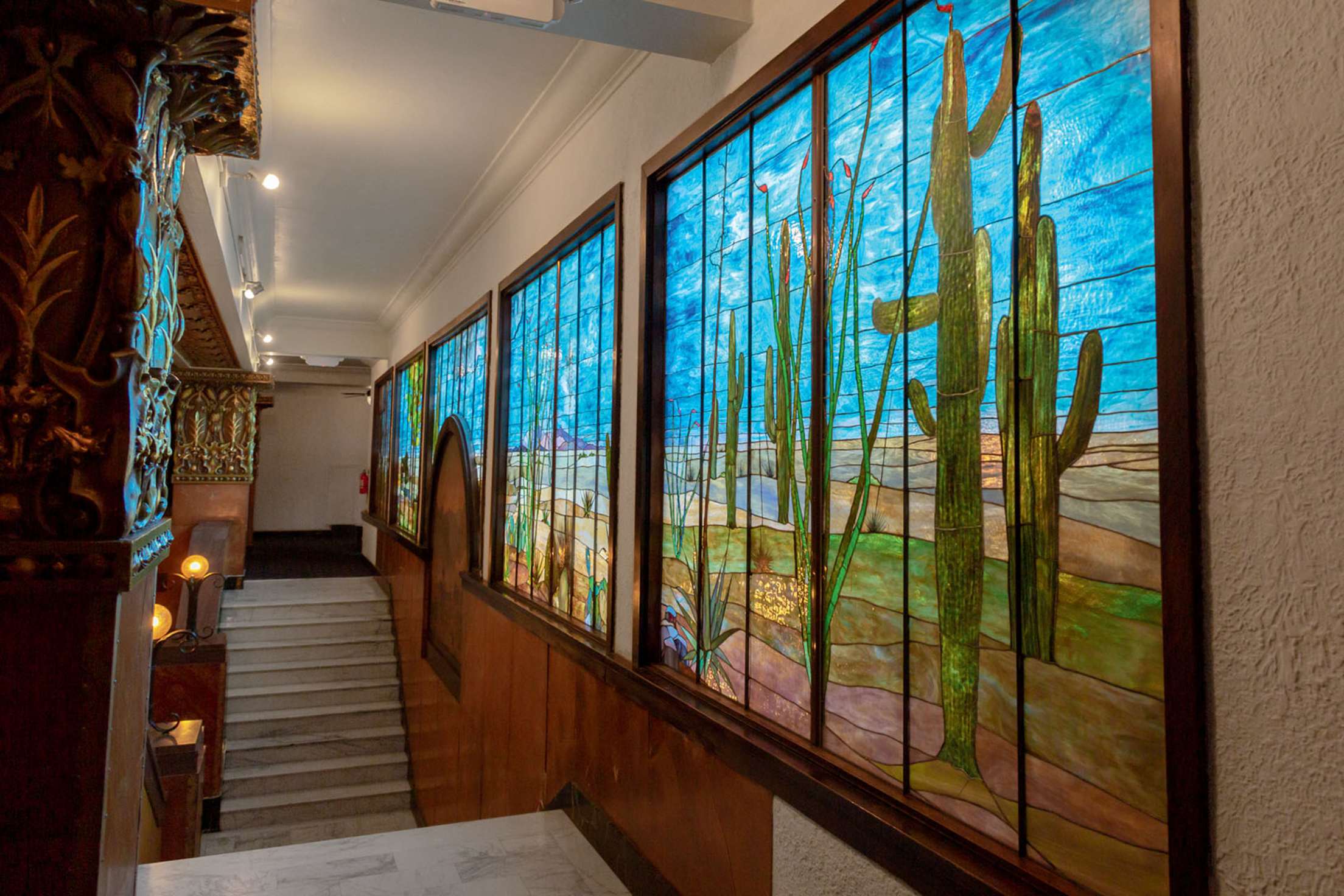
Ralph Baker, the artist behind the Gadsden's mural, studied in New York with Louis Comfort Tiffany.
That smelter was in use until 1987, and the boom times survive most gloriously at the Gadsden Hotel. Although the 1907 hotel burned down in 1928, the lobby of the Gadsden's 1929 incarnation incorporates the original's pink marble columns and white marble staircase—with its seventh step said to have been chipped by Pancho Villa's horse. The staircase leads to a mezzanine where a luminous, 42-foot-long stained glass mural depicts a Southwest desert scene complete with saguaros and agaves. Becky and I mount the fabled stairs to get a closer look at the artwork. We've seen the piece several times now, and each time we look, we notice something new.
On our return to the lobby, we run into Lawana Diffie. If you're going to strike up a conversation with a Douglas local, you can't do any better than Diffie. She has lived here for the past 22 years, but her roots run much deeper. Her grandparents had a homestead outside town in the 1930s, and her aunt, Ruby Hall, worked at the Gadsden for 44 years.
Diffie left and returned to live in Douglas five different times. Now she's here to stay. "There's a spirit to people, places, and things," she says. "And my grandfather believed there was magic in this land. He used to tell me, ‘You may leave. But you will always come back.' "
Her words ring in our ears as we head east out of town toward our next stop: Slaughter Ranch. Christened after its original owner, Confederate army veteran "Texas" John Slaughter, the 150-acre ranch still looks and feels much as it did in the 1800s. The main house and pond are preserved intact, and two horses wander the corral. We walk into the 1893 residence, which is appointed with period pieces such as a cowhide rug and a pink velvet fainting couch, along with a dining room table and cabinet purchased from the Sears catalog.
Outside, we trace the perimeter of the pond that Slaughter constructed, then follow a path up a small rise to see the ruins of a U.S. Army outpost, built in 1911 to observe Pancho Villa's soldiers. The remote spot provides spectacular views. To the north lies the broad green-and-gold expanse of the high-desert San Bernardino Valley; to the south, trucks speed along Mexico's Highway 2 en route to the distant, shrub-studded Sierra San Luis range.
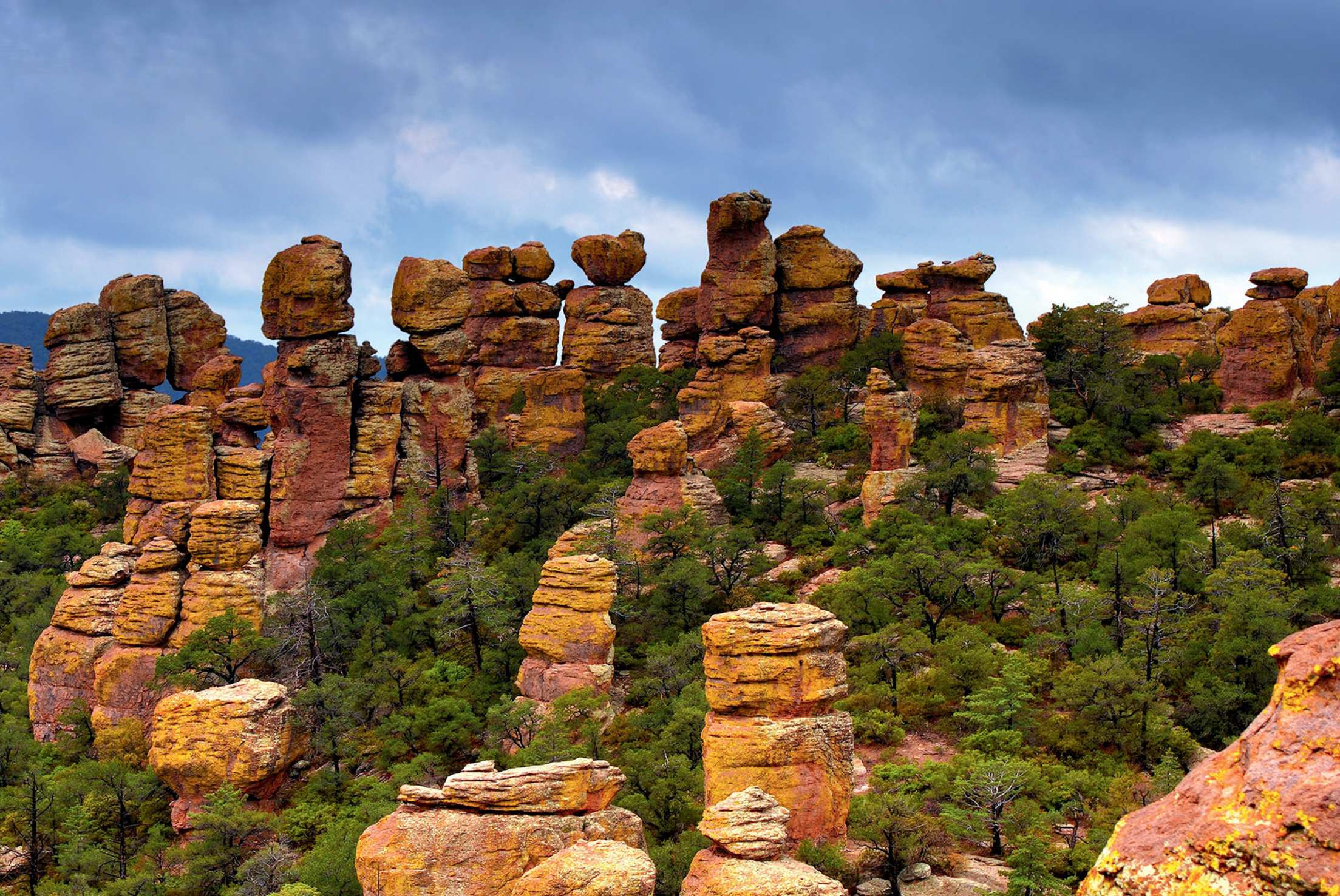
Chiricahua National Monument.
Apacheria: Douglas to Bowie
U.S. Highway 191 runs north from Douglas through the Sulphur Springs Valley, a grassland slung between the Dragoon and Chiricahua Mountains. The valley and these dramatic "Sky Island" ranges were part of Apacheria, the Apache homeland that extended from Arizona into parts of Mexico, New Mexico, Colorado, and Texas. Anthropologists can't pinpoint the date, but it's likely that the Apache arrived here sometime between 1400 and 1700.
On our journey into the ancestral Apache lands, we've decided to see two key spots. The first is a labyrinth of granite domes and cliffs in the Dragoons, named Cochise Stronghold after the great Apache leader. The second is a surreal maze of towering hoodoos across the valley in Chiricahua National Monument. Hiking among the rocks, I think of the Chiricahua Apache who once lived here. These are the cool places where they retreated to escape from the summer heat—and from U.S. forces during the Apache wars.
Anglo settlers began arriving in Arizona in the 1850s. Tensions between the newcomers and the Native Apache grew after the United States gained control of present-day Arizona through the Gadsden Purchase in 1854. With the coming of the Butterfield Overland Mail, a stagecoach line connecting St. Louis and San Francisco, the groups increasingly came into contact.
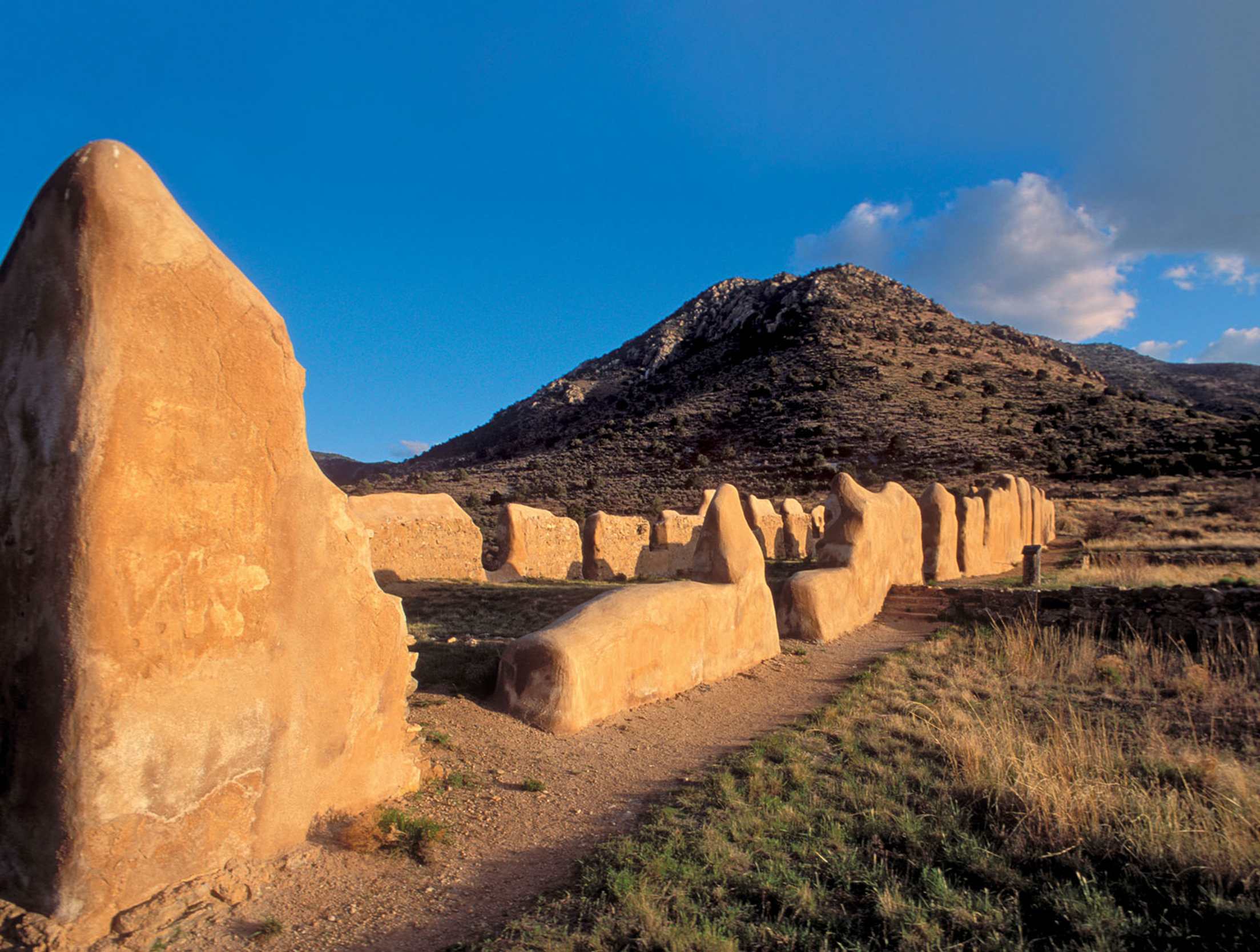
Established by U.S. forces during the Apache wars, Fort Bowie now lies in ruins.
The stagecoach stopped at Apache Spring, a verdant spot in today's Fort Bowie National Historic Site that had long been a water source for the Chiricahua. It was here, in 1861, that tensions boiled over and the brutal, decades-long Apache wars began. It was here too that U.S. soldiers sent Geronimo and his people by train to Florida, following the surrender at Skeleton Canyon in 1886.
Along a three-mile round-trip hike to the visitor center and remains of Fort Bowie, we listen to the same sounds the Chiricahua heard so many years ago: the trilling of Gambel's quail, the cooing of doves, and the whirring wings of hummingbirds. The remnants of the rampart's walls appear to be melting back into the earth. Only the occasional, distant sound of cars shortcutting between I-10 and Highway 186 on Apache Pass, tires crunching on unpaved road, breaks the silence. Otherwise, we're alone with the ruins, our thoughts, and the slowly setting sun.
Keep rolling with AAA Auto Services, from routine maintenance to emergency roadside assistance.