8 Hidden Gem Road Trips in the West
It’s all about the journey on these scenic drives.

If you haven’t gone on a leisurely road trip in a while, now’s the time to start planning one. There’s so much beauty to enjoy in the West that it’s hard to know where to start, so try one of these off-the-beaten-path routes—most doable in a day—that offer starry night skies, wildlife, and quirky roadside attractions.
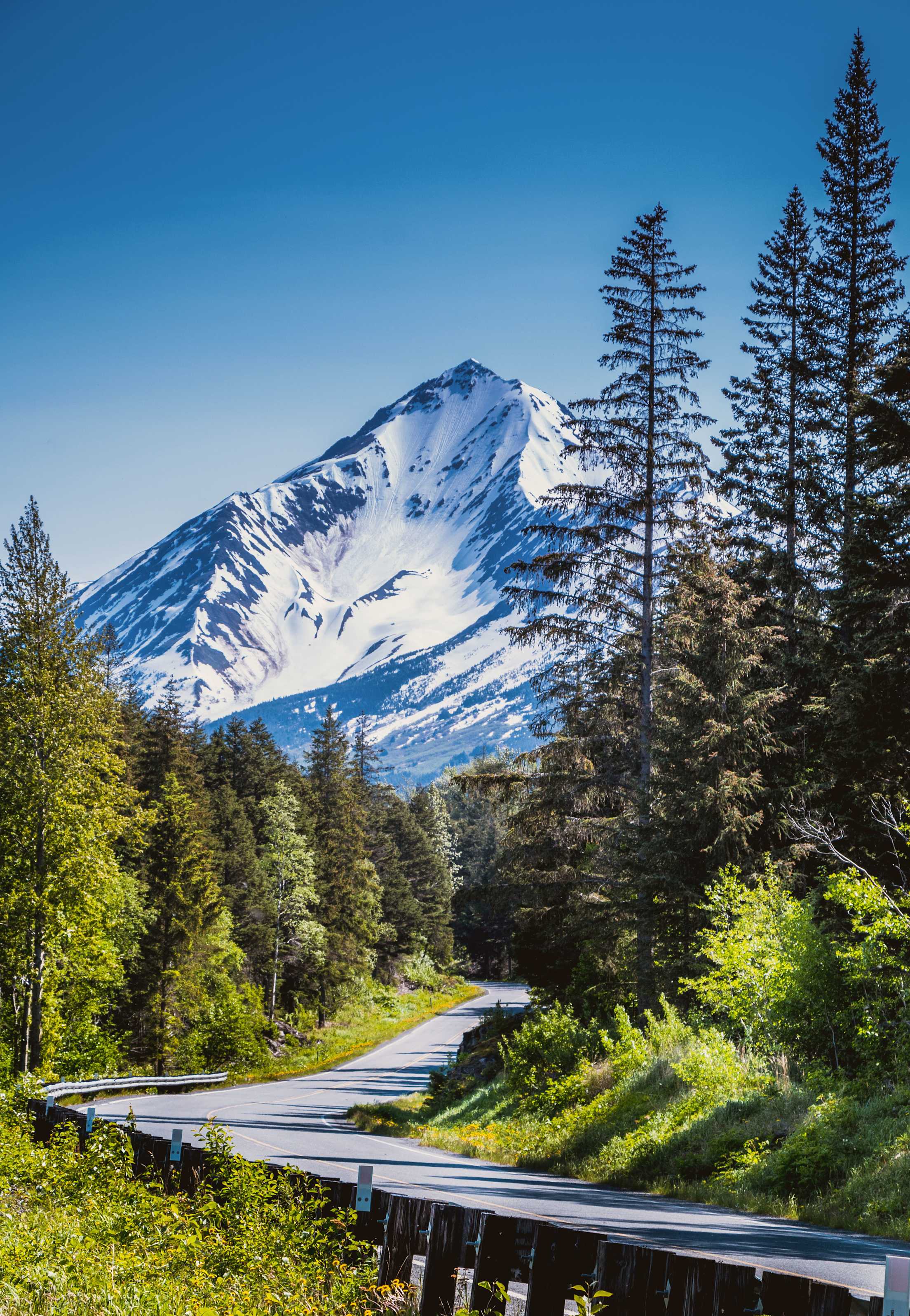
Alaska: Anchorage to Hope (88.39 miles)
Whether it’s the start of a drive down Alaska’s Kenai Peninsula or a day trip after a cruise, this road trip ventures from Alaska’s largest city to one of Alaska’s first gold-rush towns. Along the way, hike mountain trails, photograph eagles diving for dinner, and watch Dall sheep traverse the steep mountains along the route. (Tip: If you’re driving between mid-July and August, consider stopping along the Turnagain Arm waterway to spot beluga whales.)
You’ll head south on the Seward Highway (State Hwy. 1)—the Chugach Mountains on your left, the glittering waters of Turnagain Arm (fingers crossed for sun) on your right—but first, spend some time with the Anchorage Museum’s art collection to see how the state’s raw beauty has inspired artists for centuries.
Drive south about 20 minutes to Potter Marsh, where migratory birds take up temporary residence each summer. Continue south and, since the morning has probably left you hungry, go 11.9 miles to Birch & Alder for bagels. Back on the road, make use of any and all pull-offs along the water to sightsee. There’s plenty of life along the way, from wildlife to surfers.
Turn right on Hope Highway, which winds 17 miles into town. While the village of Hope has become a go-to spot for local music, it’s far more of a standout during its quieter moments. A stroll through Hope offers an instant understanding of why the town’s locals choose to call it home. Walk out along the water and enjoy its panoramic views. Explore the collection at the Hope and Sunrise Historical and Mining Museum. And, before leaving town, make sure to stop by Sourdough Dru’s Gold & Gifts to pick up souvenirs and meet the owner, who, when it’s not too busy, takes the time to share some top-notch stories of local life. —J.S.
Arizona: Phoenix loop (403 miles)
Of course, it’s hardly unheard-of to road-trip between Arizona’s two biggest cities, Phoenix and Tucson. But with our route’s under-the-radar stops it can feel brand-new. From Phoenix, drive one hour southeast to Casa Grande Ruins National Monument in Coolidge. This lesser-known sacred site was home to the ancestral Sonoran Desert people and includes a Great House that dates to the 1200s.
Continue on to Tucson and pedal across town with Tucson Bike Tours, which offers three different guide-led bike tours focused on city history, colorful murals, and delicious tacos. From here, it’s a one-hour drive to Dos Cabezas WineWorks, a winery and tasting room located in Arizona’s Sonoita wine region. Settle in with a glass of wine and a wood-fired pizza. You can even spend the night across the street at the Sonoita Inn.
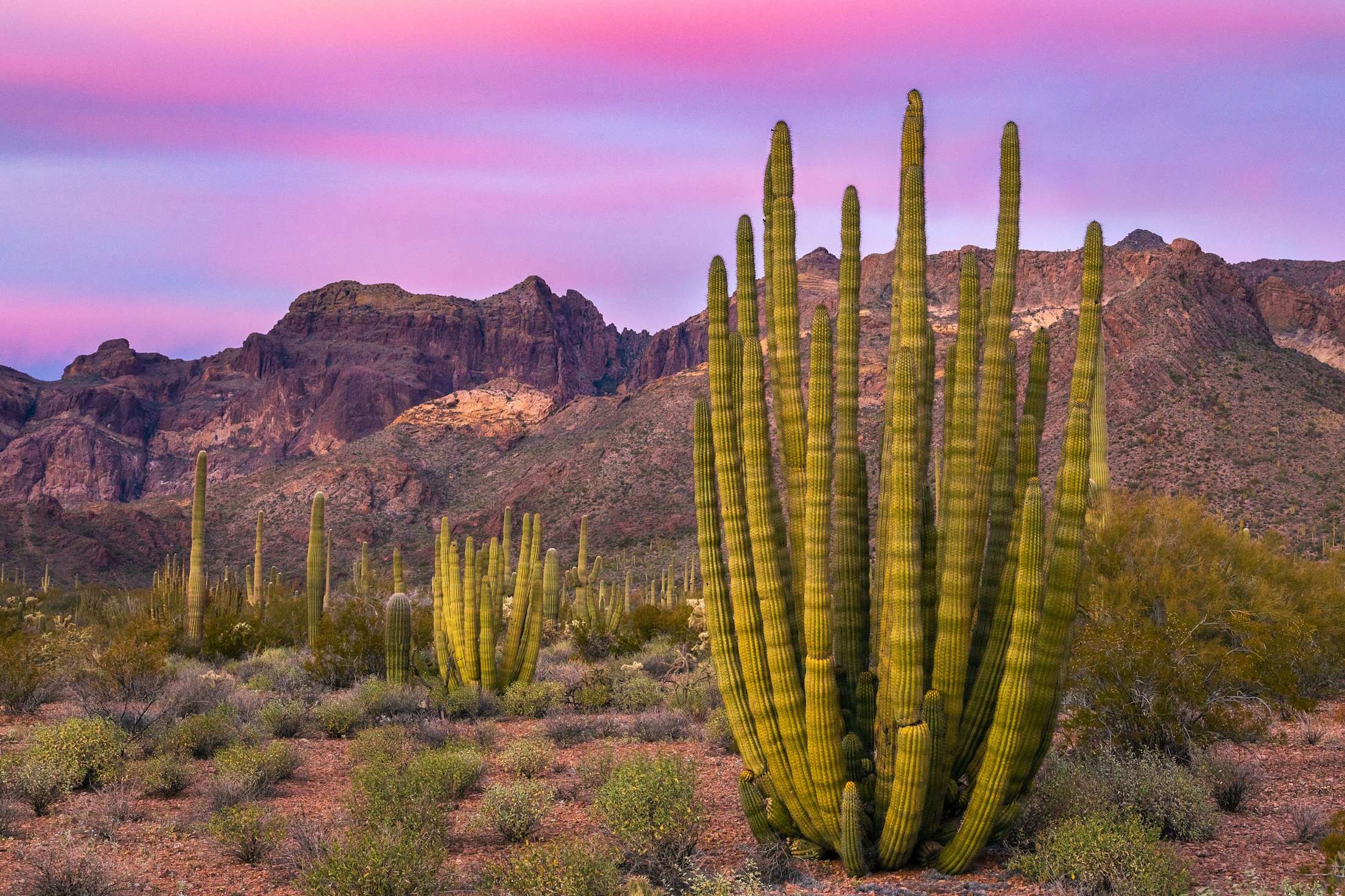
Next, head three hours West to Organ Pipe Cactus National Monument. Designated a monument in 1937 to protect a stretch of Sonoran Desert wilderness, it’s home to 31 species of cactus, 36 resident bird species (along with several hundred more during migration in the spring and fall), and some of the craziest-looking lizards you’ll ever see. Experience everything the park has to offer along scenic drives and miles of trails for all levels and abilities. One of the easiest hikes, the 1.2-mile Arch Canyon Trail, offers up a must-see—a double arch that formed millions of years ago in the rhyolite, a reddish-brown volcanic rock.
Take the long way back to Phoenix, stopping by Apache Junction for the Superstition Mountain Museum, which features a model railroad, a geology exhibit, and a replica of an Old West town. Continue on two miles to Lost Dutchman State Park, with its scenic hiking trails, camping sites, dark sky star parties, and legendary lost gold mine. —E.G.
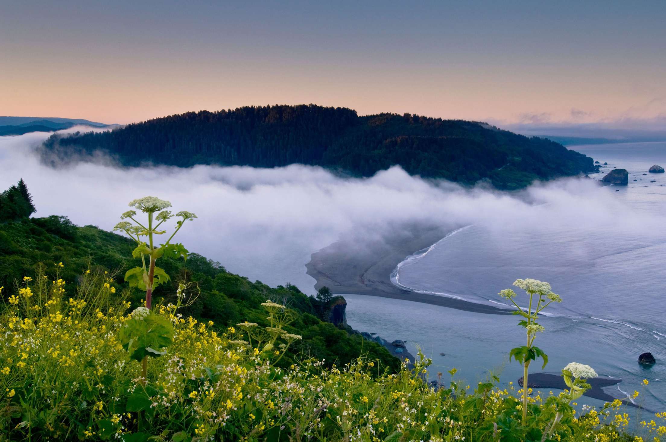
California: Yreka to Willow Creek (152 miles)
A history trip spanning Northern California’s industrial past and an exploration of nature’s abundance, this route provides plenty of chances to stretch both your mind and your legs. Along the way, trails in Klamath National Forest and float trips in Six Rivers National Forest will tempt you to extend it just one more day.
Kick off the trip in Yreka by meeting some dearly departed characters of mining days long past. The Siskiyou County Historical Society’s by-appointment cemetery walking tours are lively affairs that will put a sepia filter over the miles ahead.
Then head north on State Route 263 for 8.4 miles before turning left on State Route 96, which follows the Klamath River. The Klamath is California’s longest designated Wild and Scenic River with tributaries that flow from Mount Shasta in the Cascades, among other sources, before exiting into the Pacific Ocean near Crescent City.
Along the way, the river supports trees from pines to redwoods, and a storybook-worthy range of wildlife including owls, salamanders, antelope, and more. Watch for waterfalls tumbling down the mountains. If you’re looking for an outdoor adventure, park the car in Happy Camp for a multiday guided raft trip. With rapids that tend to be more like ripples, the lower Klamath is a solid beginners’ trip.
One of the greatest tales told about this area concerns a rather hairy figure named Bigfoot. The center of all things Sasquatch is Willow Creek, the last town on State Route 96 before you turn off onto State Route 299 toward Eureka on the California Coast. —J.S.
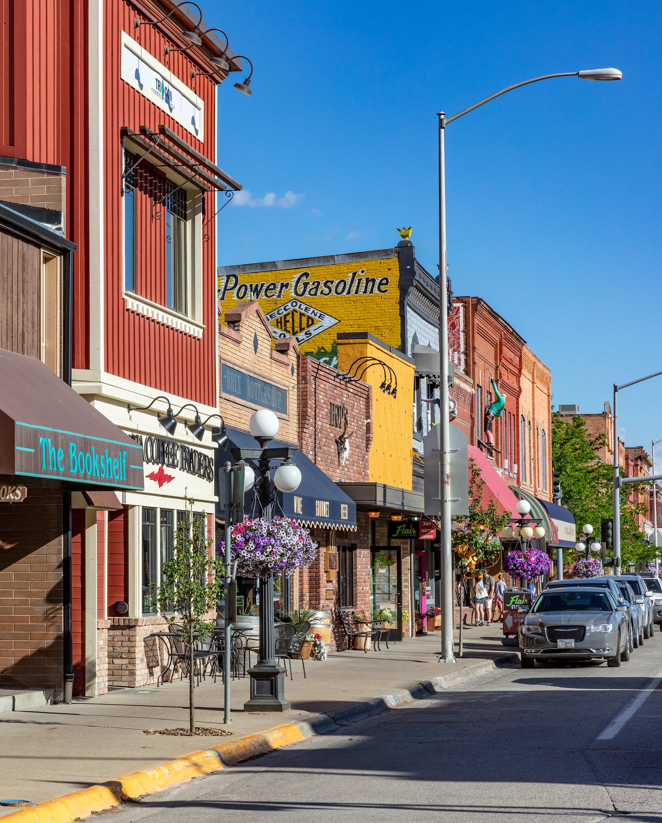
Montana: Kalispell to Anaconda (207 miles)
This route starts close to Glacier National Park, which, of course, should get some of your time before you hit the road for some wildlife watching, water activities, and hiking a national forest.
Kalispell’s downtown anchors the city in its origin story. It started as a railroad town for the Great Northern Railway. Modern-day owners of buildings downtown have been working to restore them to their early 20th-century good looks. But, as you’ll see at the Conrad Mansion Museum, once home to the city’s founder, they reflect a cozy and laid-back approach. If it’s baseball season, check out a Glacier Range Riders game, the local team in the rookie Pioneer Baseball League.
Just south of Kalispell, Flathead Lake’s nearly 200 square miles could keep kayakers busy for days. If you plan on kayaking along the lake’s southern half, you’ll need a tribal recreation permit from Confederated Salish and Kootenai Tribes of the Flathead Reservation.
Continue your drive on Highway 83 heading south. If possible, time your trip to coincide with the Old Salt Festival at the Mannix Family Ranch in Helmville, which guarantees pit-cooked barbecue and plenty of live music on the stage. This is ranching country, and the festival is run by the Old Salt Coop, home to a butcher shop and restaurants. You’re in solid hiking and horseback-riding country here. The 12-mile end-to-end Gould Helmville Trail offers opportunities for both activities.
Then head to Anaconda, where you could spend several days on outdoor adventures, from fishing to zip-lining. Even non-golfers could find themselves getting into the sport at the Old Works Golf Course, designed by golf legend Jack Nicklaus, where the holes are surrounded by remnants of a former copper-smelting facility. —J.S.
Nevada: Las Vegas to Ely (383 miles)
Great Basin National Park in Nevada ranks among the least-visited national parks in the country, despite being home to the second-tallest peak in the state, a curious cave system, pristine alpine lakes, and a grove of ancient bristlecone pine trees. This route starts in Las Vegas and logs most of its miles on U.S. Route 93.
Make E.T. Fresh Jerky in Hiko your first stop. It’s nearly two hours north of Las Vegas and lures visitors with a supersize alien mural and a dozen varieties of beef jerky, including hickory and honey teriyaki. Continue on to Kershaw-Ryan State Park to hike the 1.4-mile Canyon Overlook Loop, with striking views of lush green canyons. Make a pit stop in Caliente, which is home to a ghost town and a historic railroad depot, to refuel at the Barrow Brew Co., a local coffee truck.
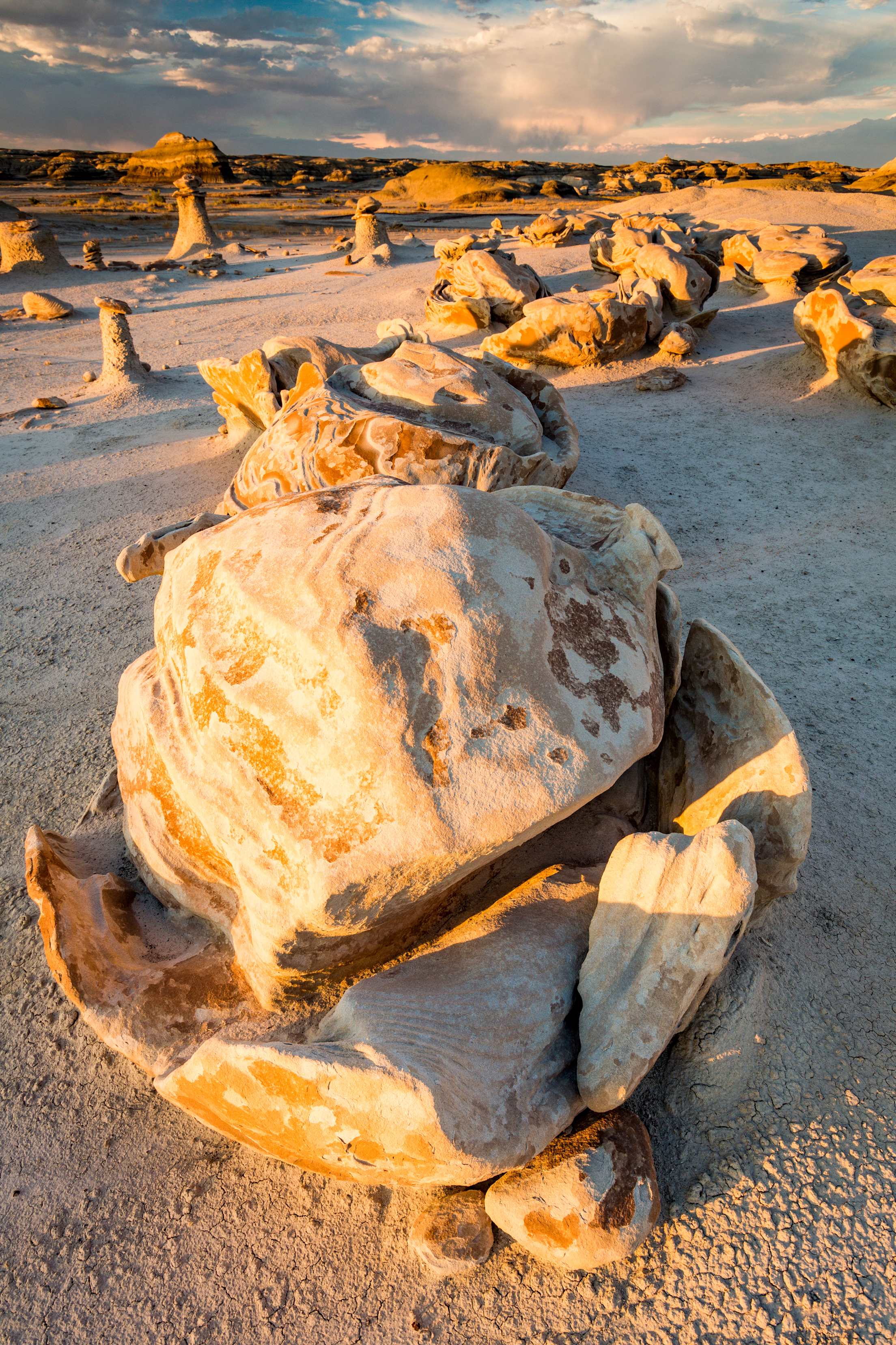
From Caliente, it’s 20 minutes by car to Cathedral Gorge State Park, which awes with its otherworldly rock spires and cave-like rock formations, including Moon Caves and Cathedral Caves. There are several short hiking trails, including the Miller Point Trail, with views of the scenic gorge at the top. Stop for lunch in historic Pioche at the rustic Gunslingers, which serves up subs, sandwiches, salads, and milkshakes.
Great Basin National Park is another two hours and a short detour off U.S. Route 93, but it’s well worth the drive. Plan on a full day at Great Basin for a ranger-led tour of the Lehman Caves, a scenic drive across the park with stops at Mather Peak and Wheeler Peak overlooks, and hiking on several trails. One popular hiking trail is the Alpine Lakes Loop, which leads to Stella Lake and Teresa Lake. End the trip in Ely to check out the East Ely Railroad Depot Museum and Ward Charcoal Ovens State Historic Park with its six beehive-shaped charcoal ovens that were used to process silver in the latter half of the 19th century. —E.G.
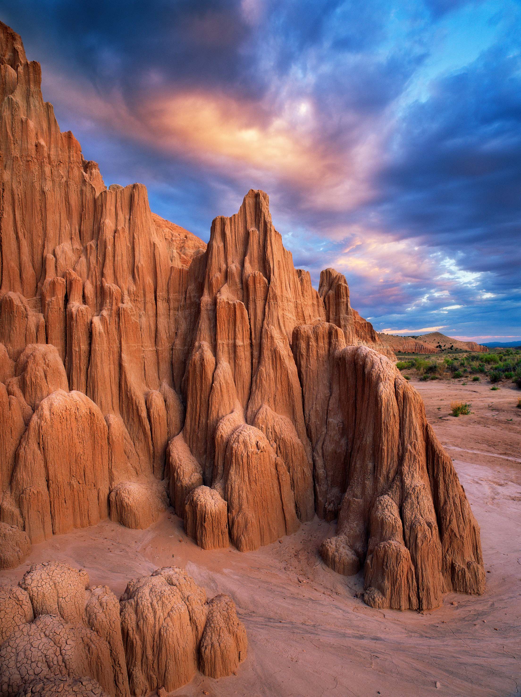
New Mexico: Chama National Forest to Bisti/De-Na-Zin Badlands Wilderness Area (243 miles)
This route contains enough for a long weekend and even a weeklong vacation, but it also makes an ideal day trip to escape to an inspiring landscape. It begins in Carson National Forest, which sits under New Mexico’s tallest mountain, Wheeler Peak, at 13,161 feet. The nearby Continental Divide Trail is a 3,100-mile undertaking, but you can step onto the trail for a taster hike of just a few miles. Tent and RV campers alike will want to set up here at one of the many established campgrounds. (This is bear country, so be sure to keep a clean campsite.)
Then head north to Chama, a village seven miles south of New Mexico’s border with Colorado. Kids and adults will find much to love during a daytrip on the Cumbres & Toltec Scenic Railroad. The train goes underground through tunnels and high up as it crosses a trestle 137 feet above a rocky gorge. After getting your fill in Chama—be sure to include a plate of huevos rancheros at Fina’s Diner—it’s time to head west on Highway 64
About 80 miles from Chama sits New Mexico’s second largest lake in Navajo Lake State Park. Paddlers novice and more experienced will find plenty to love (and there are rental boats waiting there for you). Then ramble on to an area that will be one of the trip’s highlights.
Seeing rock formations that defy gravity, you’ll be tempted to call Bisti/De-Na-Zin Wilderness “otherworldly,” but it’s very much of and on Earth. A smaller area of badlands than South Dakota’s National Park, Bisti/De-Na-Zin is just as rich in rock formations, stellar photo ops, and (at times challenging) hiking that will keep you busy for days. —J.S.
Utah: Moab to Moab loop (700 miles)
The state is well-known—maybe too well-known—for the “Mighty Five,” Utah’s wildly scenic national parks, which include Zion and Bryce Canyon. Yet there’s so much more to see there, including state parks and national monuments such as Bears Ears and Natural Bridges, that often rival those big-name parks for the range of experiences and stunning sites they offer. The trip starts and ends in Moab, with plenty of dramatic majestic scenery along the loop.
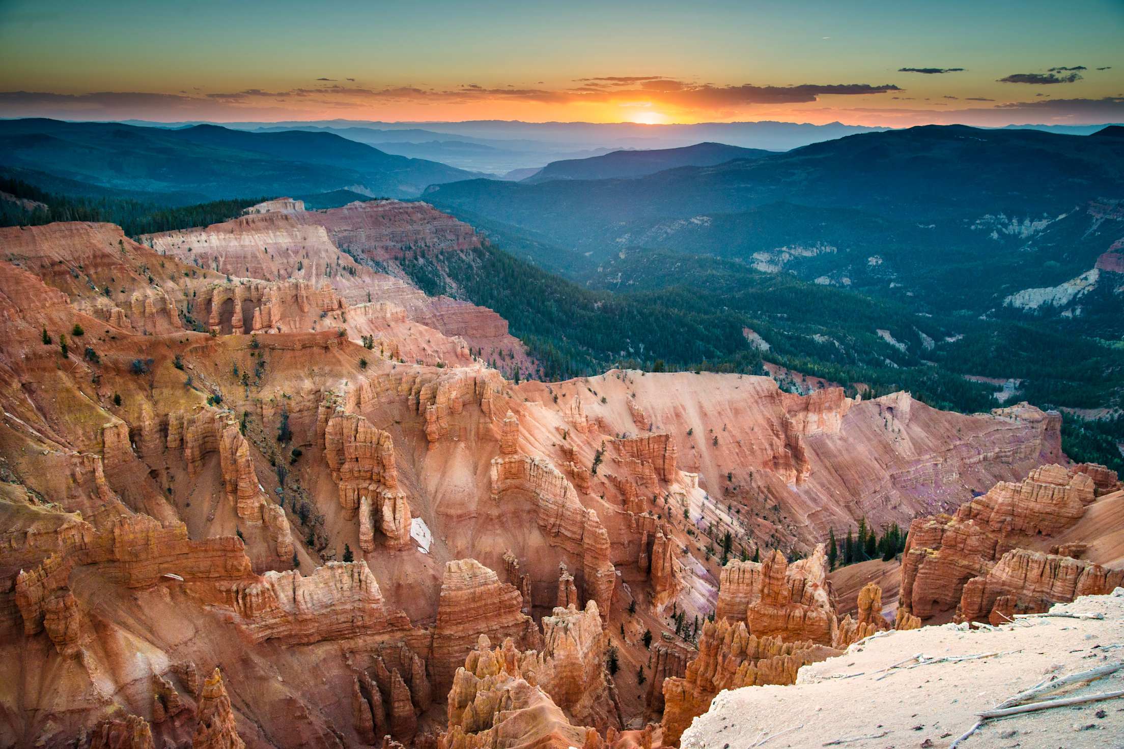
From Moab, start with a 4.5-hour drive to Cedar Breaks National Monument. It’s a dead ringer for Bryce Canyon National Park, yet sees a fraction of the visitors. Revel in stunning red rocks and dramatic hoodoo formations. In summer, Cedar Breaks wows with lush displays of colorful wildflowers such as cushion phlox and kittentails. Celebrate a day well spent with a pint and a burger at Last Chair Grill & Brews in nearby Brian Head.
After Brian Head it’s nearly 5.5 hours to Natural Bridges National Monument, but you’ll want to break up this trip with a stop at Capitol Reef National Park. Yes, this is one of the Mighty Five, but it’s incredibly underrated, and you drive right through the park on the way to Natural Bridges. It’s a cinch to stop at key attractions Panorama Point and Fruita Schoolhouse without leaving the main road.
Designated in 1908, Natural Bridges National Monument features three sandstone bridges within its boundaries. Consider overnighting in the park’s campground. Natural Bridges is an International Dark Sky Park, so the stars are pretty much guaranteed to put on a good show. Next, drive 30 minutes to Bears Ears National Monument, with its towering buttes and ancient cave dwellings. From there, it’s a two-hour return drive to Moab. —E.G.
Wyoming: Thermopolis to Saratoga (218 miles)
While there’s nothing wrong with planning a trip centered around sitting in hot springs, this route from Thermopolis to Saratoga could also be the perfect add-on after days of hiking at nearby Grand Teton or Yellowstone National Parks, or the many nearby national forests. Or drive it in reverse after exhausting yourself at Rocky Mountain National Park.
Start your soaking in Thermopolis at Hot Springs State Park, where the therapeutic waters run a constant 104°F. Explore the grounds to spot bison herds and take in a 360-degree view from the park’s suspension bridge over the Bighorn River. Stay in a wellness state of mind by grabbing a salad and smoothie at Nature’s Corner, a local spot downtown.
Then head south down U.S. Route 20 and on to U.S. Route 26, which crosses into the Wind River Reservation of the Eastern Shoshone and Northern Arapaho tribes. Spend time learning about the tribes’ history and cultures at the Northern Arapaho Experience Room.
Continue south on Highway 135 to Sweetwater Station, where U.S. 287 takes you to Whiskey Peak, a ridge trail that tops out at 9,225 feet and serves up loads of wildflowers along the way. If hot springs remain the driving force for the trip, though, continue on to Saratoga, which offers soaks both free—at Hobo Hot Springs—and for a fee—at the casual-leaning Saratoga Hot Springs Resort. —J.S.