
10 Awe-Inspiring Geological Wonders in the West
The West's national parks and monuments reveal stories of geological upheaval and transformation.
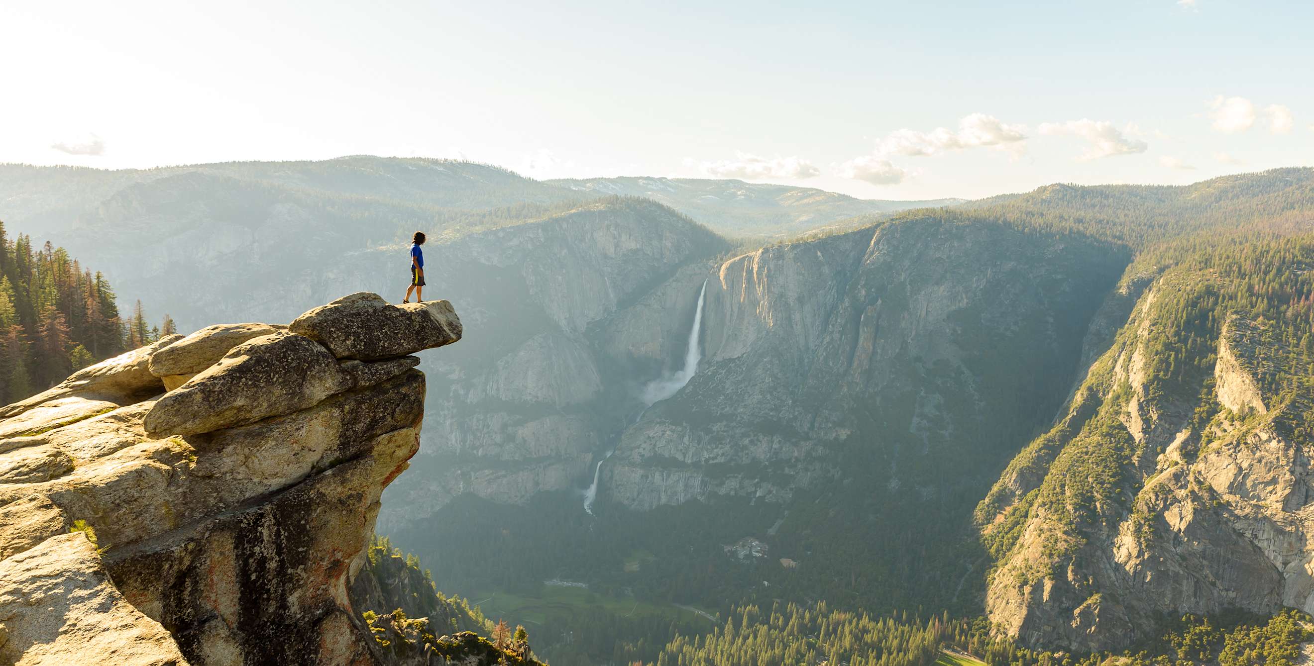
At this point in the earth's history, the most spectacular wonders of geology in the United States are found in the West. For the last 500 million years, dynamic forces have been staging geologic dramas from Sedona to Seattle.
Here in the West, oceanic plates smashed into the continent with enough force to create the Rocky Mountains and the volcanic Cascade Range. A massive wall of water crashed from Idaho to the ocean, mountains blew their tops, seas of lava swallowed up the land. Surreal sandstone sculptures that seem to defy ordinary explanation, canyons so deep they boggle the mind, and columns of rock that bear all the hallmarks of skilled craftsmanship have all been left behind for us to ogle in wonder. Here's where to see the best geological wonders in the West.
Badlands, Makoshika State Park, Montana
Wherever crumbly sedimentary rock has been exposed to a few million years of weather, you're going to find some rough land. But the terrain at 11,500-acre Makoshika State Park in eastern Montana is extreme by any standards: chunks of orange sandstone teetering on thin white stalks, skeletal gray ridges, tortuous gullies, and near vertical canyon walls. Makoshika means "Land of Bad Spirits" in Sioux, a fair reflection of the land.
The nearby Yellowstone River long ago washed away the top layer of soil, uncovering rocks significantly older than badlands specimens from the Dakotas. The lower strata of brown and gray clay and shale date from the time of the dinosaurs, which explains the abundant fossils—including remains of Tyrannosaurus rex and Triceratops—discovered at the park. The upper layer, a younger, denser sandstone in shades of yellow and orange, erodes more slowly than the older rock below, an imbalance that gives the sculptured scenery a peculiar character shown in the caprock formation called Twin Sisters.
Drive to Artist Vista or the Sand Creek Overlook for memorable views of this weathered landscape.
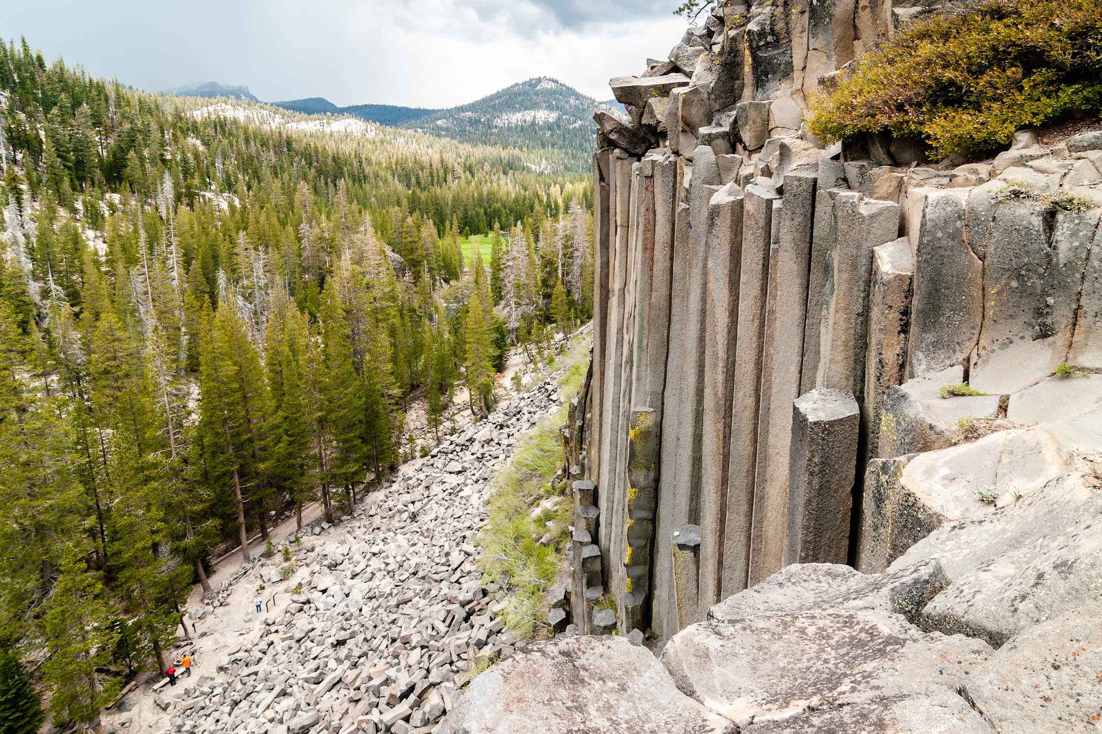
Devils Postpile National Monument, in eastern California, is made up of hexagonal columns of basalt.
Columnar Basalt, Devils Postpile National Monument, California
The saga behind Devils Postpile National Monument in California has a simple plotline: Given the chance, nature creates order out of chaos. These famed hexagonal columns of basalt, some rising 60 feet, fit together with the uniformity and precision of expert masonry. The seminal event was a volcanic explosion about 100,000 years ago that unleashed a torrent of exceptionally hot, runny lava southeast of present-day Yosemite National Park.
The molten river hit a barrier—probably a glacial moraine—and pooled into a lake some 400 feet deep. The lava shrank as it cooled, and pressure cracked the young rock into hexagons, the shape that offers the greatest stress relief with the fewest cracks. Ice age glaciers sheared off the column tops and polished the remaining rock to a high gloss. Take a short walk from the monument campground (open June to October) to see the results up close. From above, the ground looks like interlocking tiles on a beautifully designed—yet all-natural—walkway.
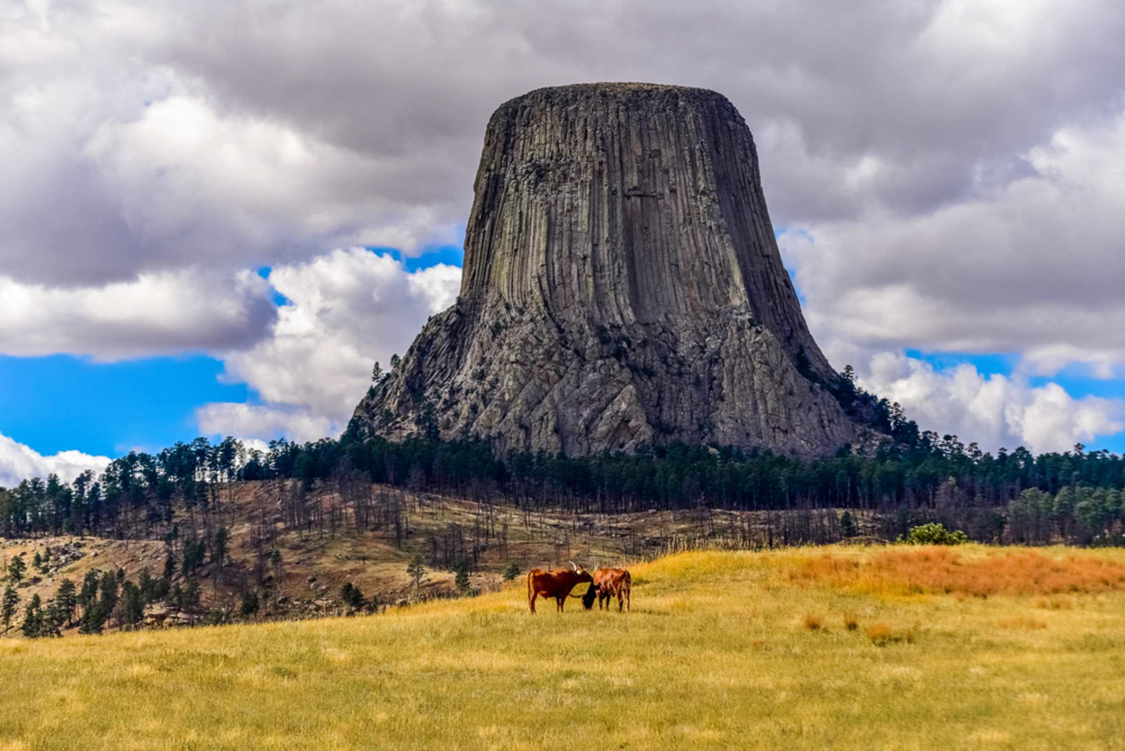
Wyoming's Devils Tower towers over the surrounding landscape.
Devils Tower, Wyoming
How did this solitary 867-foot column of lava rock end up in the middle of rolling forest and ranch land in northeastern Wyoming? Towering above the treetops, it looks as if it had been dropped from space or pushed skyward by some great underground force, though the real explanation is neither of these.
According to the most widely accepted theory, it's an accident of timing that we can see Devils Tower at all. For roughly 95 percent of its existence, the entire block lived belowground, formed by molten lava that welled up into a layer of sedimentary rock 50 million years ago. Starting about 1 million or 2 million years ago, rain and snowmelt slowly washed away the surrounding sandstone, siltstone, and shale, leaving the much sturdier mass behind.
From the visitor center—or better yet, from the short trail around the tower—you can see the beautifully symmetrical columns typical of lava that has cooled slowly. Lean in for a look at the dark gray and greenish gray igneous stone flecked with white feldspar crystals, clear signs of the pillar's hot past. To paraphrase Richard Dreyfuss in Close Encounters of the Third Kind (partially filmed here), this place means something.
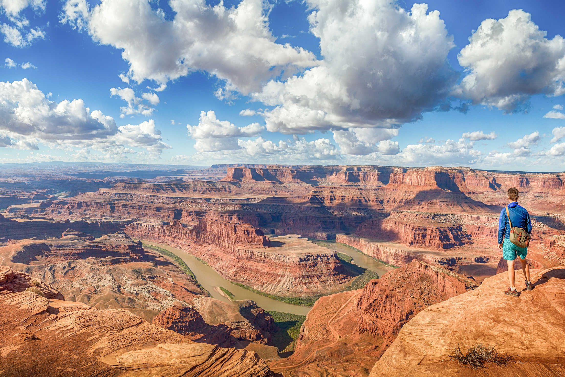
Experience the scale of the Grand Canyon in person.
Grand Canyon, Arizona
Colorful sandstone, shale, limestone, and clay settled here from 250 million to 550 million years ago, an era when what is now central Arizona was intermittently the shoreline of a sea. Eventually, sediment from that sea piled up over 5,000 feet deep, providing plenty of material for spectacular erosion in the ages to come. Starting about 6 million years ago, newly uplifted mountains to the north sent a snow-fed river crashing downhill. Snaking around like a garden hose turned on at full blast, the water dug through the soft earth to create a canyon 18 miles wide, 277 miles long, and one mile deep.
Stop at viewing spots along the South Rim (and North Rim) to marvel at the multicolored layers exposed by the river. At the canyon's bottom, the Colorado flows past crystal-rich granites and schists 1.8 billion years old. And it's still digging.
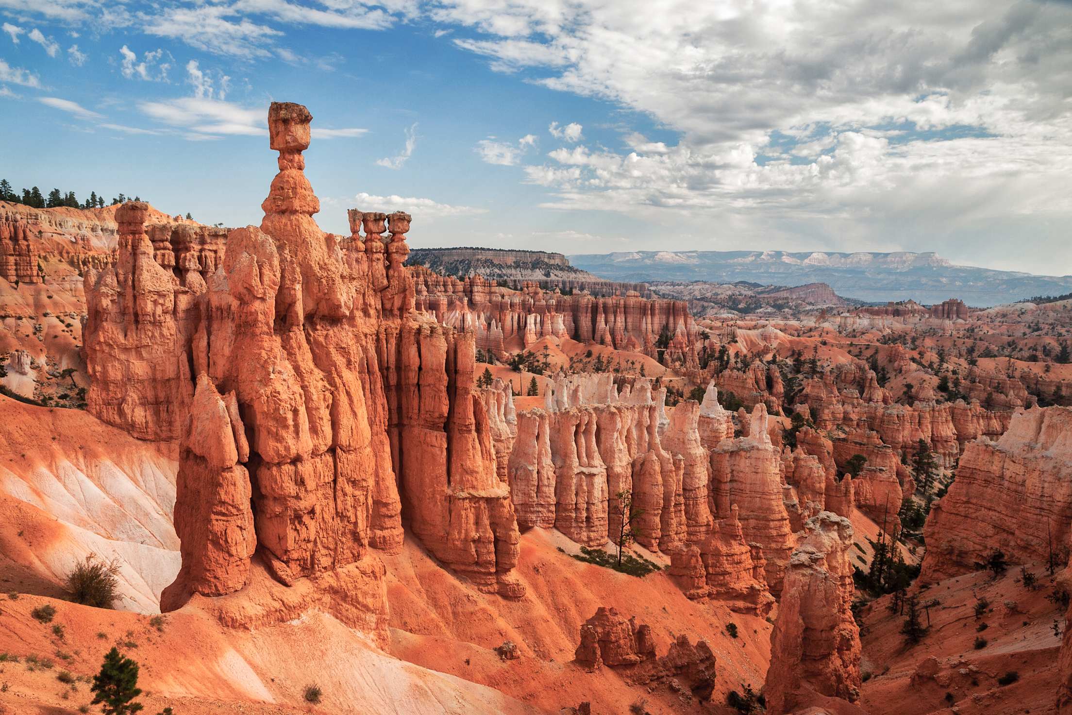
Thor's Hammer rises above the surrounding hoodoos in Bryce Canyon.
Hoodoos, Bryce Canyon National Park, Utah
Stone spires called hoodoos abound in southern Utah's Bryce Canyon National Park. On a bright morning at Inspiration Point, the spindly fingers of limestone shine in alternating bands of orange, red, gray, and apricot.
The iron-rich rock here was once sediment at the bottom of a giant mud puddle that stretched across much of present-day Utah 30 million to 55 million years ago. About 8 million years ago, the Bryce Canyon area slumped off from the rising Colorado Plateau, exposing what had become hardened rock to corrosive rain and frost. The erosion that created the hoodoos is still at work, and scientists expect that they will be gone in about 3 million years.
Stop at viewing areas along the main road to see these natural sculptures in all their permutations, including the topheavy Thor's Hammer at Sunset Point, the delicate Wall of Windows at Bryce Point, and the white Poodle at Rainbow Point. Several trails take you down to hoodoo level.
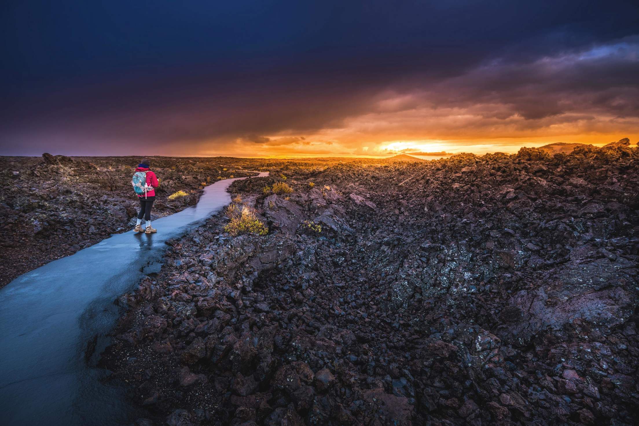
Craters of the Moon lava fields in Idaho.
Lava Fields, Craters of the Moon National Monument and Preserve, Idaho
Despite its name, there's really nothing lunar about this landscape. If anything, it feels more like a piece of Hawaii plopped down in central Idaho. A sea of black rock stretches for miles, evidence of an underground hot spot that hasn't completely cooled down.
Between 2,000 and 15,000 years ago, molten lava repeatedly broke through a series of cracks in the earth's crust—known as the Great Rift of Idaho—flowing out in smooth, ropy streams for as much as 45 miles before hardening. Occasionally, chunks of rock blasted out with explosive force, creating a patchwork of jagged boulder fields. Geologists predict that the area will erupt again, perhaps in another 200 years.
Starting at the visitor center on Highway 93, you can drive a seven-mile loop to see volcanic rock in its many forms, including "cascades" resembling petrified white water and broad, symmetrical cinder cones several hundred feet tall. The cones—miniature volcanoes gone dead—look red or black from a distance. Viewed up close, shards of volcanic glass in the fine stone shimmer in shades of purple and gold that play with the light. The moon has nothing that can compare.
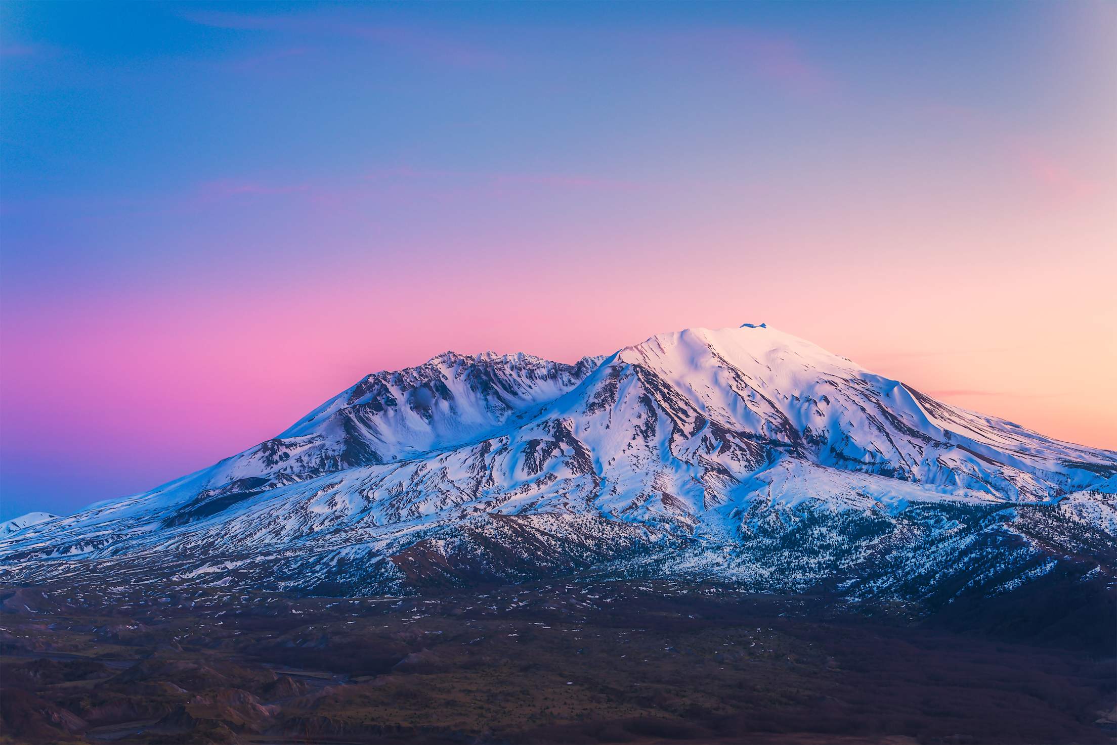
Mount Saint Helens at Sunset.
Mount St. Helens, Washington
When it blew its top on May 18, 1980, Mount St. Helens in Washington blasted away 3.7 billion cubic yards of debris in a matter of seconds, sending a plume of ash 15 miles into the air. Nearly 30 years later, the still lively volcano is preparing for its next act. A slow, steady eruption from 2004 to 2008 sent more ash skyward and filled the crater with enough lava to pave a seven-lane highway across the country.
The dome of fresh lava has stopped growing, but eventually pressure will build up again. Experts don't expect a cataclysmal incident any time soon—good news for people at the popular Silver Lake visitor center 52 miles to the west. Occasional bursts of steam still puff up from the crater, and snow often covers the upper reaches of its treeless slopes. Created by the heated collision of oceanic plates with the continent, Mount St. Helens may now be the country's most picturesque disaster site.
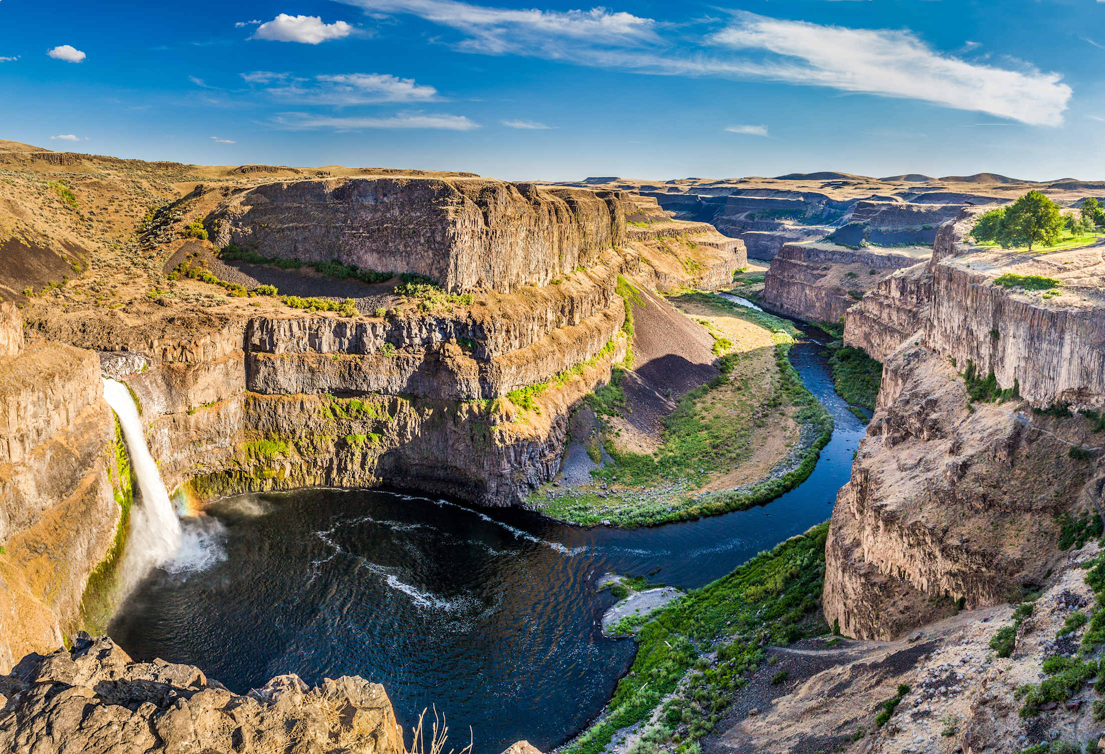
Palouse Falls.
Palouse Falls State Park, Idaho and Washington
Imagine a torrent of water flowing with the combined force of every river in the world. Now multiply that by 10—we're talking 10 Amazons, 10 Niles, 10 Mississippis—and you've envisioned the forces that shaped the undulating Palouse scablands in northern Idaho and eastern Washington. The ground here ripples like a muddy lakeshore after a big wave, except that some of the ripples reach the height of three-story buildings.
Several times between 12,000 and 15,000 years ago, an ice sheet crept into the Idaho Panhandle, blocking the Clark Fork River and creating a lake 200 miles long and 2,000 feet deep. Time and again the ice dam broke, unleashing an inland tsunami that swept east into Montana and west all the way to the Pacific.
Among other feats of geologic engineering, these walls of water diverted the Palouse River and carved the 200-foot cliffs that form the backdrop for Palouse Falls, a beautiful cascade surrounded by desert in southeastern Washington.
The falls roar at full strength in spring and early summer—just a faint echo of the torrential past.
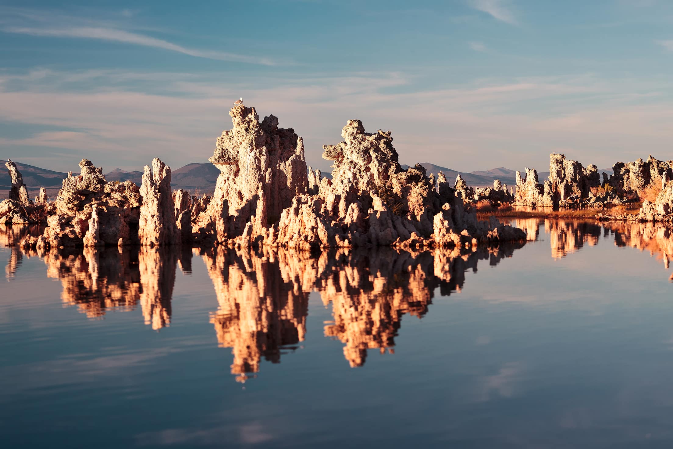
Tufa Towers rise out of Mono Lake in California.
Tufa Towers, Mono Lake, California
Ghostly white columns of limestone rise out of the water up to 30 feet above the serene surface of Mono Lake, a 65-square-mile expanse of blue salt water in the California desert east of Yosemite.
Unlike most geologic wonders, the scene near Mono's south shore was at least partly caused by human activity. In their natural state, the limestone formations—technically called tufa—would be completely underwater, where only the brine shrimp could appreciate them. Tufa towers formed when freshwater springs bubbled up into the highly alkaline lake water. In a simple chemical reaction, calcium from the springs combined with carbonate in the lake to form limestone. The resulting spires were as porous as sponges, so more fresh water continually seeped through the sides and up to the tops, adding perhaps one inch of height every year.
The tufa pillars became exposed—and 900 years of growth came to a halt—when Los Angeles started diverting water from four of the lake's five feeder streams in 1941. Over just a few decades, the lake lost half its volume. Now, thanks to protective measures taken during the 1980s, it's slowly filling again.
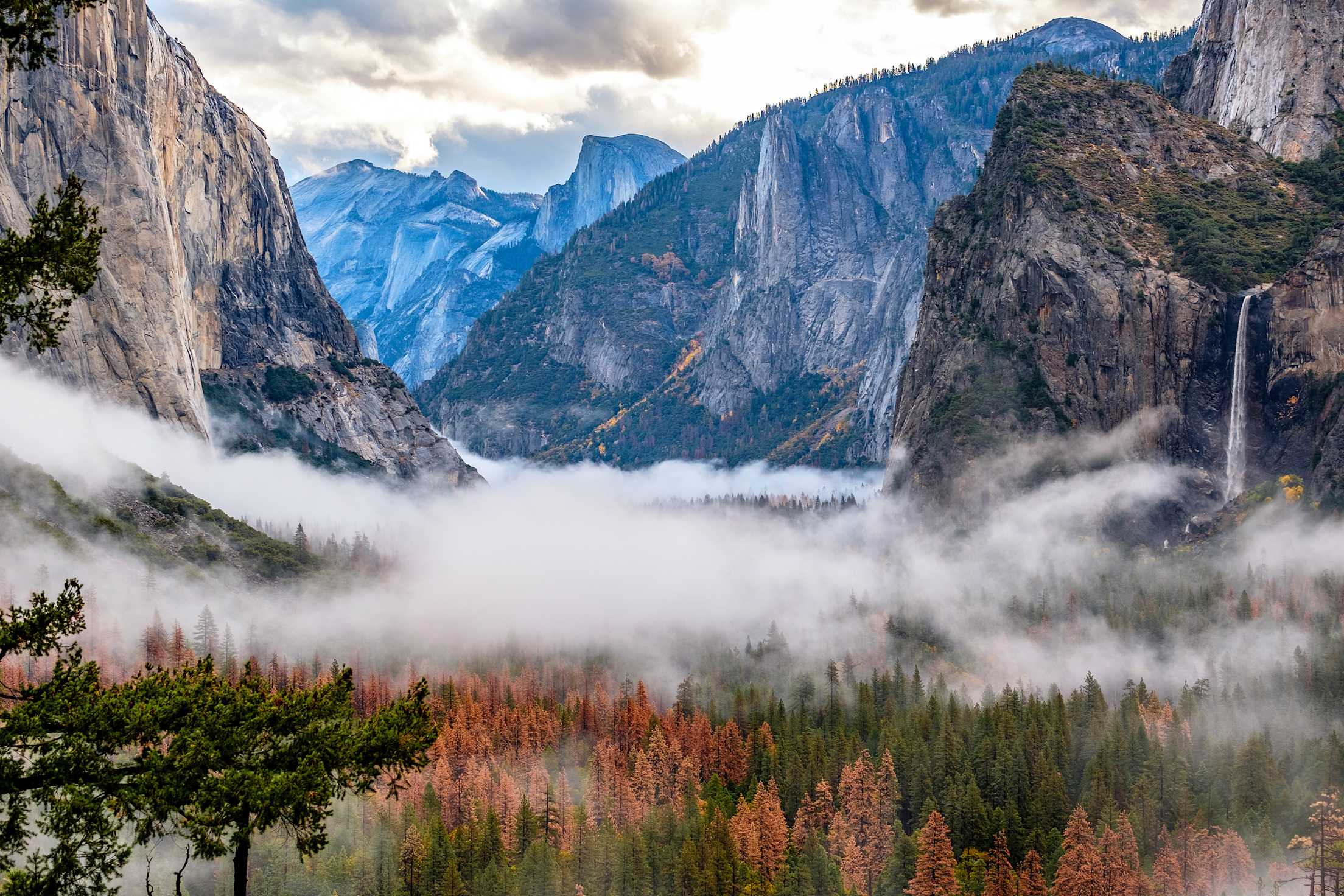
Yosemite Valley from Tunnel View.
Yosemite Valley, California
The classic signs of glacial handiwork stamp Yosemite Valley: massive edifices of granite lining a wide, U-shaped basin. Naturalist John Muir was among the first to speculate about Yosemite's icy past, but even he might not have imagined the timescale involved. Over 1 million years ago, a sheet of ice thousands of feet thick plowed through what was then a narrow valley, covering everything except the very top of Half Dome. The ice gouged a deep, wide path through the mountains, easily carrying off huge blocks of granite.
A much shallower glacier that came through 10,000 to 30,000 years ago dammed up the valley's western end, leaving behind the broad hill between El Capitan and Bridalveil Fall. When the glacier melted, the valley filled with water, creating a lake that dried up over the course of millennia.
Stop at Valley View along Northside Drive, look skyward, and imagine the valley-wide, skyscraper-high ice field that formed all this.