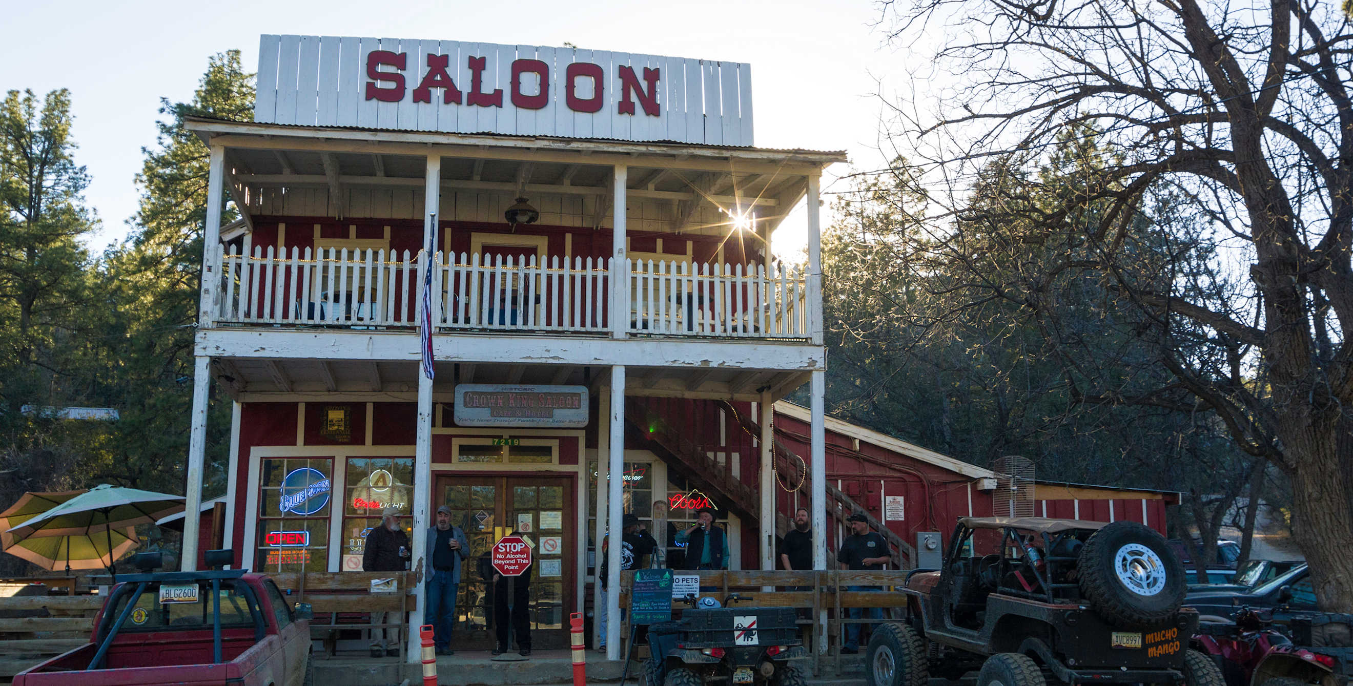
The Wild Ride to Crown King, Arizona
It's the journey alongside the destination that makes this trip memorable.

If you savor trips in which getting there is half the fun, then you'll relish the ride to Crown King. It's the nearest pine-forested community to the Phoenix metro area, but it also is arguably the most remote town in Arizona.
The easiest access from Phoenix, off Interstate 17 via Bloody Basin Road, starts with 10 unpaved miles through the tiny historic desert towns of Cordes Station and Cleator, then climbs more than 2,000 feet up the east side of the Bradshaw Mountains. This steep 13-mile segment is a twisting dirt road featuring hairpin turns and more than three dozen single-lane sections carved through hard-rock hillsides. The road was actually a railroad bed for the Bradshaw Mountain Railway until 1926. Although passenger cars can traverse the road when it's dry, the sheer drop-offs and dugways prompt some visitors to purchase "I Survived the Drive" T-shirts when they reach the Crown King General Store.
Crown King was among more than 40 mining communities that sprang up in the Bradshaws after the Walker and Weaver exploration parties struck gold there in 1863. Only a few of these boomtowns survived. Crown King's evolution from mining town to tourist attraction began in the 1920s when Phoenix leaders were seeking ways to keep residents from fleeing the region during the summer heat. The City of Phoenix leased Prescott National Forest land in Horsethief Basin 7 miles southeast of Crown King and used federal Depression-era money to build a dance pavilion, cabins, general store, and guard station. The Civilian Conservation Corps constructed the Horseshoe Dam and campground structures nearby. It opened in 1937 with a grand ball.
The lack of modern air conditioning and poor road access led to the demise of the resort in the 1960s, but people still trek to Crown King to escape the heat and have fun in the cool pines. "It's laid-back, and there are definitely a lot of interesting characters," says Crown King Saloon owner Erica White about her community of approximately 100 full-time residents surrounded by the Prescott National Forest.
Four Ways to Crown King
The journey to the top of the Bradshaws is popular for off-road vehicles (the unpaved route from east of Crown King is passable for passenger cars, but becomes difficult after heavy rain or snow). Unpaved routes lead up to Crown King from every cardinal direction, with the southern route from Lake Pleasant being the most challenging. Senator Highway leads north to Prescott, while the Minnehaha Flats road connects from the west. Numerous side roads lead to abandoned mines in the Prescott National Forest (where it's illegal to take anything but photos).
"There's so many places to branch off up there," says Richard Taylor, who co-founded the Arizona 4x4 Club based in the Valley of the Sun. He urges first-timers to join a club outing if they want to attempt the Lake Pleasant route.
History Still Alive
The general store and the Crown King Saloon, both century-old landmarks dating back to the area's mining heyday, anchor each end of the block-long Main Street.
From May to October, you can stop by the Crown King Historical Society's tiny museum next to the general store. It's celebrating the Crown King schoolhouse's centennial this year with a special display. To this day, the one-room schoolhouse functions as the town's K-8 school.
At the museum or general store, pick up a walking tour brochure with a map of nine nearby historic structures and the 1894 Gladiator Mine 10-stamp mill. The Gladiator mill now is located inside the Mill Restaurant, along with other mining artifacts. Mill owners Mike and Sam Christie say they hope to get an 1800s-era ball mill up and running outside the restaurant this summer.
The town hosts several events including an apple festival, chili cook-offs, and a golf tourney in which competitors tee off on Towers Mountain and whack balls down to the saloon while making stops for hot dogs and beer.
On the way down the mountains toward Cleator, you'll enjoy panoramic views that spread to the San Francisco Peaks. High-clearance vehicle drivers seeking more adventure can try one of the other routes back down to the desert.